
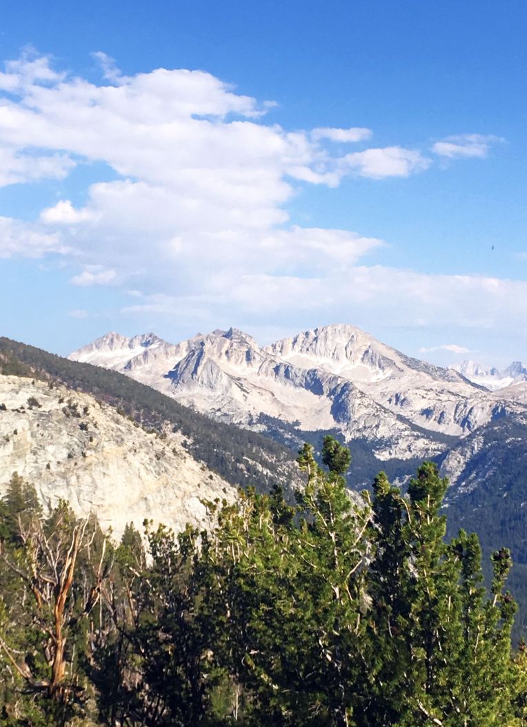
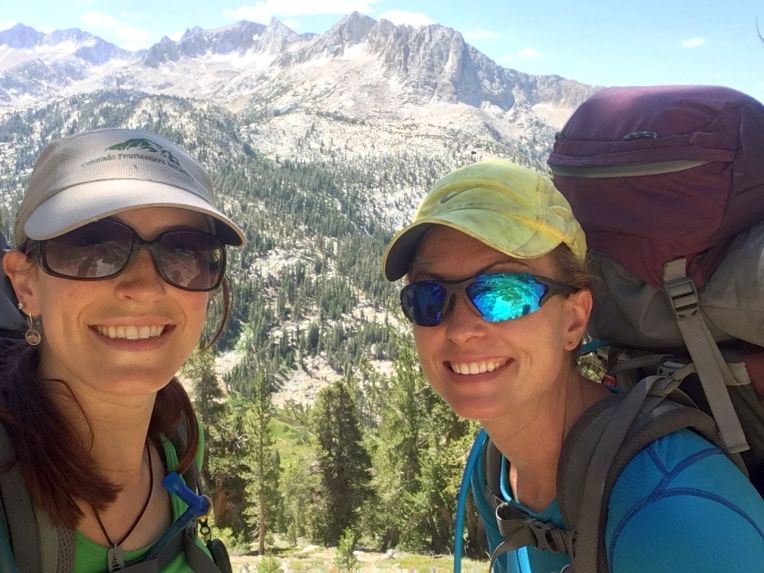
About six months ago, I received a text in a group chat I had with Tony, Dan and Kate who I met on the Colorado Trail last year. It was Dan, saying that he had won the lottery for four JMT permits with a start date of July 22! I was elated – the John Muir Trail was high on my list, but I had not been pursuing a permit because of the hassle and 97% denial rate. Kate knew right away that she couldn’t join us because of a cool work opportunity. Then I checked my calendar and remembered that I had to be in Newport, Oregon on August 5th for my grandmother’s birthday party with the whole family. My elation crumbled. How could I turn down what may be the hike of a lifetime? But hiking the JMT takes 3 weeks! Or does it? I did the math – I would have exactly 14 days to complete ~221 miles and nearly 47,000 feet of elevation gain. I mulled it over and asked Tony and Dan if they were ok with a pretty aggressive pace and they agreed! I also suggested that the fourth permit spot should go to my friend Justina – she and I have a similar story and passion for the outdoors. She had mentioned wanting to do the JMT someday so I offered it to her and she accepted!
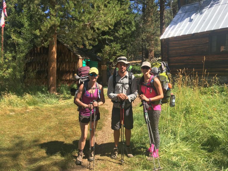
Months went by; I did some planning, but felt prepared after last year’s hike. I dehydrated food, mailed my resupply bucket, and secured a ride from the Fresno airport to Yosemite National Park with my awesome aunt. Shortly before we were set to leave, Tony accepted a great new job that started during the hike so he could no longer come. Quite suddenly, it was the day before we flew out and of course we still had a lot to do. Justina came over and we packed and prepared until after midnight, then woke up at 4:30 to head to the airport. Bill dropped us off, and we were on our way! After a short layover in Phoenix, we landed in Fresno and were almost immediately greeted by my aunt Leslie. We collected our bags, picked up a few last minute items and began the 2 hour drive to Yosemite.
It’s true what they say about Yosemite Valley – pictures do it no justice. We caught our first glimpse of Half Dome, then saw a few waterfalls and El Capitan. A return visit to the Valley is definitely in the future. We headed towards the backpackers’ campground and I started wondering how we would find Dan, then a moment later my phone rang and the caller ID said “Yosemite National Park”! Sure enough, it was Dan calling from a pay phone. We parked, met up with him, finished packing up, and said goodbye to Leslie and thanked her profusely for the ride! We set up camp, ate a quick dinner, and went to bed early for the next day’s hike.
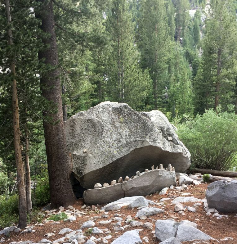
 Unfortunately, the trail doesn’t actually begin here.
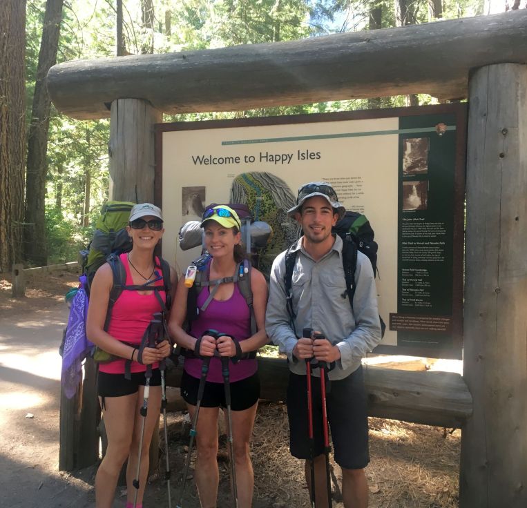
7/22/16 – Day 1. Yosemite Valley to Forsyth Trail junction: ~10 miles, 4200′ gain
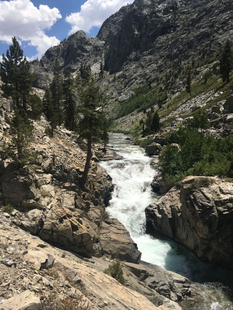
“Today was tough, as the first day always is. We left the backpackers’ camp around 9 am. We had about a mile walk to the official trailhead, went to the wrong trailhead, and then finally began a beautiful but brutally hot climb out of the valley. The crowded trail took us past two waterfalls, and we had great view’s of Yosemite’s famous granite walls.
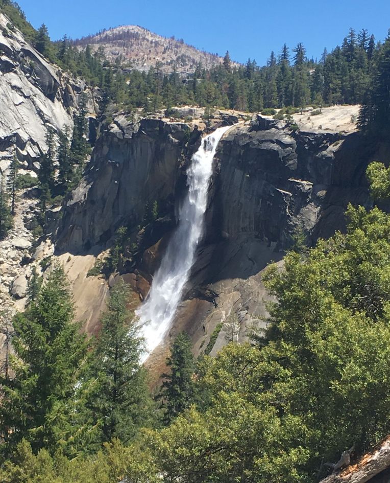 Nevada Falls
Eventually we started to see fewer people, and the trail turned into a fine dust. This unfortunately bonded with the layers of sweat, sunscreen, and DEET on my skin to form an impenetrable layer of sticky dirt. It will not come off with baby wipes, water, anything. So it has been an uncomfortable evening. We didn’t get nearly as far as we wanted today, but the heat and relentless elevation gain plus 45 pound backpacks made for a very long and difficult hike. We set up camp in a large burn scar next to another group, ate dinner, and expect to have a better day tomorrow. Spirits and stoke are high and all three of us are doing very well considering the punishing circumstances of today as a first day. Tomorrow should bring more gorgeous scenery and easier hiking.”
7/23/16 – Day 2. Forsyth Trail junction to Tuolumne Meadows: ~14.5 miles, 3200′ gain
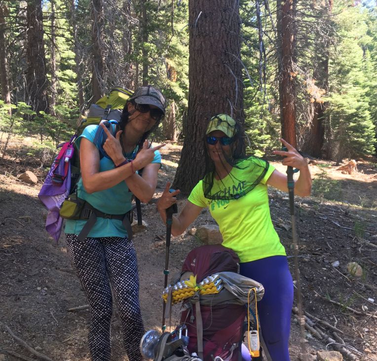 Keeping it gangsta. There were a LOT of bugs!
“Unfortunately, today wasn’t that much easier. Almost all of today was still hot and mostly not shaded. The heat and extremely dusty, sandy trail gave me painful blisters on my toes (expected) and heels (unexpected). Hopefully I can power through it because we have to start making up miles. This morning did have some nice final views of Yosemite Valley, our first look at some high Sierra peaks, and some amazing meadows and lakes. I am excited to get out of the park so it starts to feel more wild. Tonight we had to stop at Toulumne Meadows and pay for a spot at the backpackers camp. People are being very loud, even at 10 pm. That should change tomorrow – we are trying for about 16 miles and will go over Donohue Pass. Flat at first and then a final climb to the pass. Hopefully we will start getting our legs soon.”
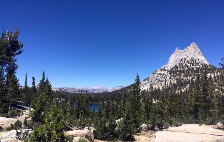 Cathedral Peak
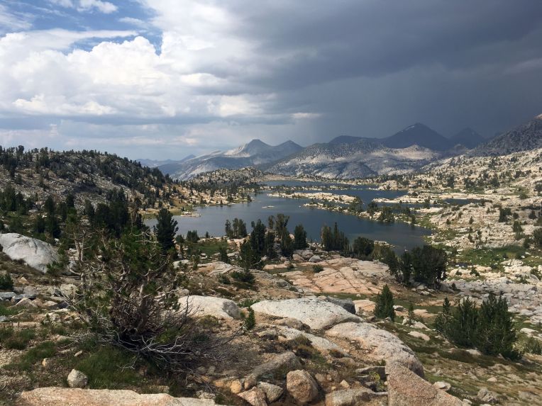
7/24/16 – Day 3. Tuolumne Meadows to Marie Lakes junction: ~16 miles, 3300′ gain
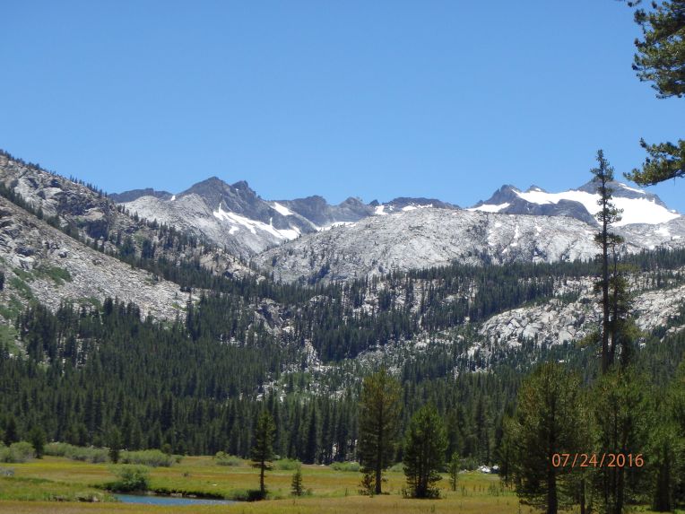
“We are definitely improving. Today started out pretty mellow, with a long hike along a meadow and the Lyell Fork of the Tuolumne River. The water was clear and enticing. After about 9 miles of mostly flat but sandy and non shaded hiking, we began our ascent to Donohue Pass. It was hot and grueling, but beautiful. Alpine lakes, wildflowers, and jagged, snow-covered peaks began to appear.


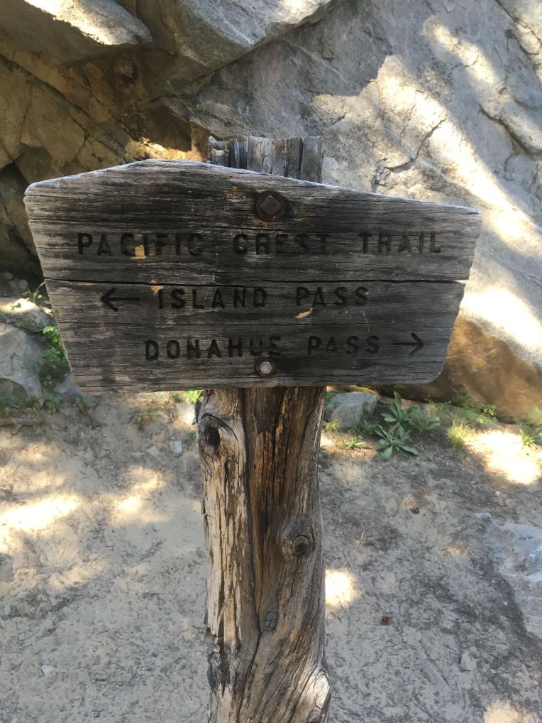
We reached the pass (11,060′) around 5 and chatted with some northbound PCT hikers, then headed down into increasingly lovely terrain. An incredible watershed with many lakes and small streams led us back into the forest, where we set up camp. We will need more days like today in order to catch up on our miles. I can’t wait to see what lies ahead!”


7/25/16 – Day 4. Marie Lakes junction to Minaret Creek junction: ~14 miles, 2600′ gain
“Ouch! The first four days have been very tough! The heat, sun, bugs, and steep terrain are worth it for the views, though. Spectacular scenery today of dramatic peaks, many clear blue lakes, flowers and cascading creeks. We laugh through the difficulty and pain. We are a good team and I am confident and eager to continue!”


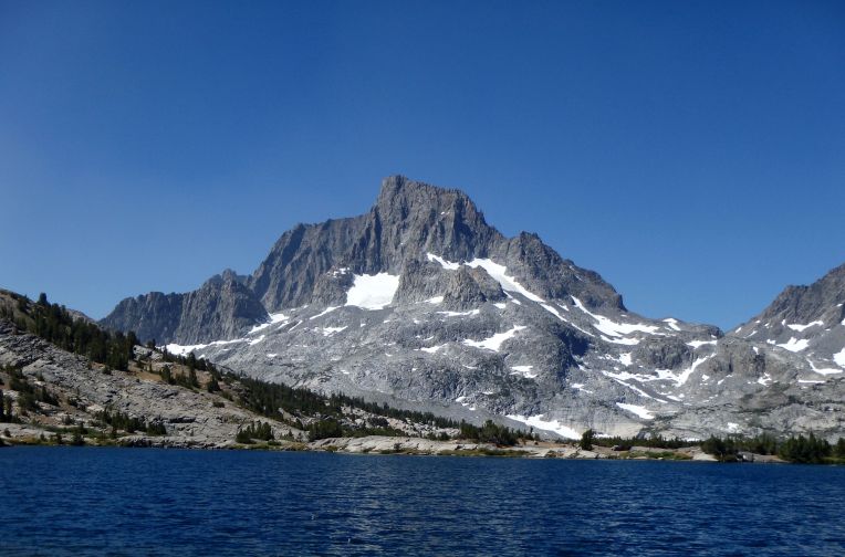
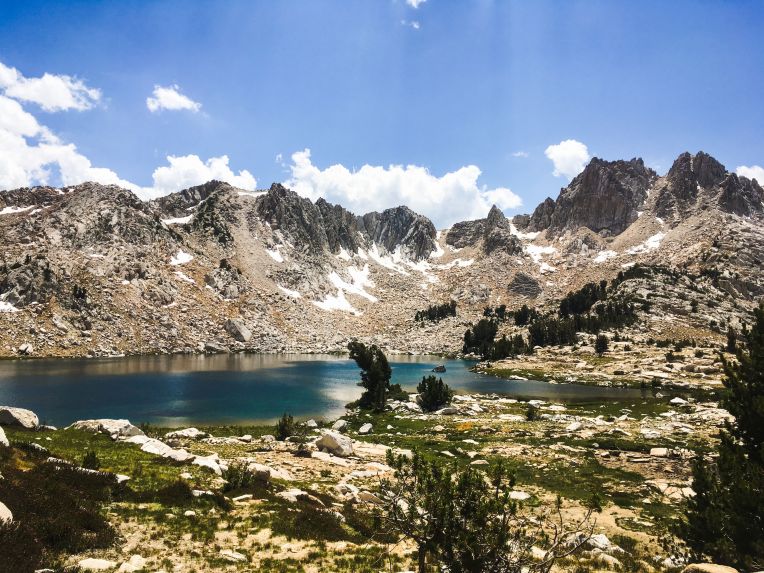
I wish I had written more about this day, because the views were truly incredible. From Island Pass, we began seeing the stunning Banner and Ritter Peaks, above the very blue Thousand Island Lake. We hiked through forest past several more beautiful lakes, up what seemed like over 50 switchbacks, and found a great but buggy campsite.
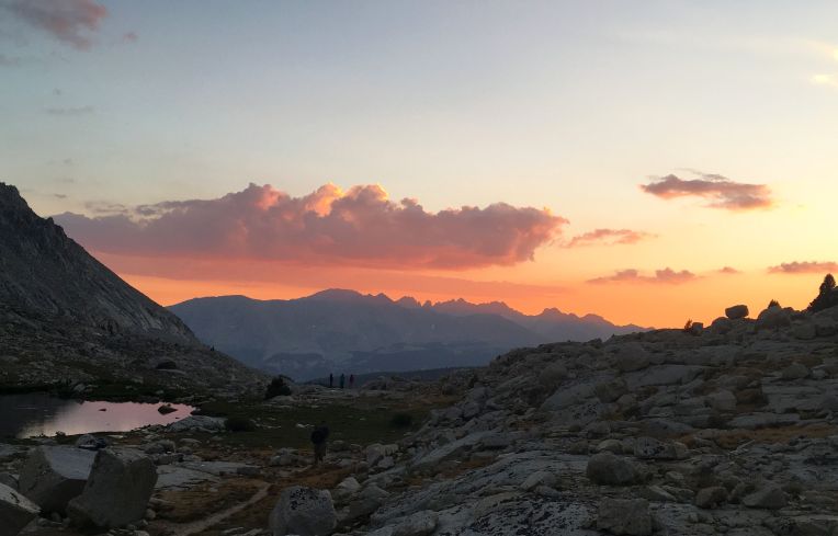
7/26/16 – Day 5. Minaret Creek junction to Purple Lake: ~20 miles, 3000′ gain
“Today was fucking awful. It was a terrible, horrible, no good, very bad day of hiking. Let me count the things that made it suck: My water filter is clogged from shitty lake water and needs to be backflushed, but I am missing the piece to do it so I am stuck having to pump water with extreme difficulty. Another day of near 90 degree temperatures with maybe 10% shade. Boring scenery for miles. The FUCKING flies! I have never experienced anything so awful. They would swarm around my head even while hiking, and if I stopped for even a few seconds they would be all over me (10 or more). I would be painstakingly filtering water, using both hands, and flies flies would be all. over. me. Oh and then I lost my balance in a creek crossing and fell, getting both of my shoes wet. While I changed socks, of course, I was swarmed with flies. If every day was like today, I would be so fucking done. However, we did start getting some pretty great views towards the end of the day. The next two days will be tough since we are still trying to make up miles, but then hopefully it will get better. I’m having some pretty bad pain. Nine days to go.”
7/27/16 – Day 6. Purple Lake to Lake Edison junction: ~16 miles, 2300′ gain
 Fake it til you make it!
“I thought today would be pretty terrible. I woke up in a bad mood, sore from yesterday and not excited for more hiking. My feet hurt a lot. The day started with a climb out from Purple Lake, then to the impossibly blue Lake Virginia, then down, then back up 1600 feet to Silver Pass. It was difficult, but the views were fantastic. A scenic death march, I thought to myself. Still not much shade, and I burned my legs from wearing shorts and long sleeves to protect my arms. Dan was far ahead as usual, and Justina and I suffered through a 3000′ descent on a rough, rocky trail. Still flies. We saw a SAR helicopter flying up through the canyon and circle a few times to eventually land in a meadow to evacuate a girl who was sick. Our feet and legs hurt more with every step as we trudged through forest looking for our final landmark/trail junction. We crossed a bridge and saw Dan at the edge of a very cold, easily accessible river. It was just before 6, and we were actually able to do laundry and wash ourselves as well as we could. It felt incredible. All the heat, filth, sweat, etc. from the last six days were washed away in the brisk water of Mono Creek. We dried off, made dinner, and planned the next two days. Tomorrow will certainly be tough – 20 miles to the Muir Trail Ranch for our resupply. I feel so much better after cleaning up today. I know we can do it! One week until Whitney!”
 Near Silver Pass
7/28/16 – Day 7. Lake Edison junction to MTR cutoff: 21 miles, 4300′ gain
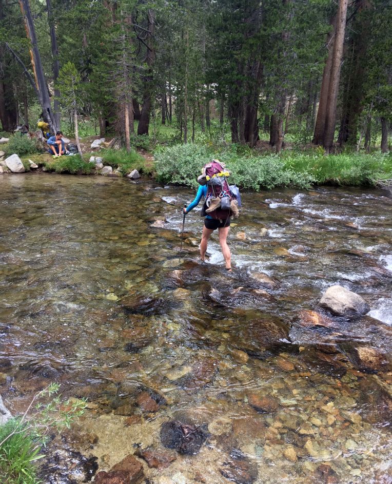 Justina wades across a creek crossing
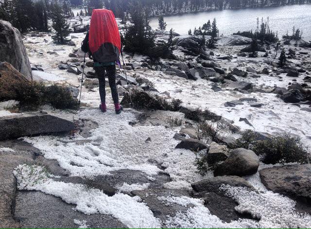
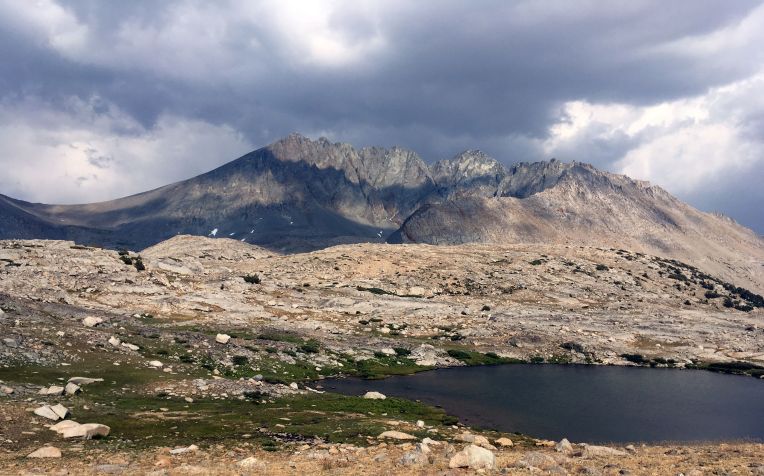
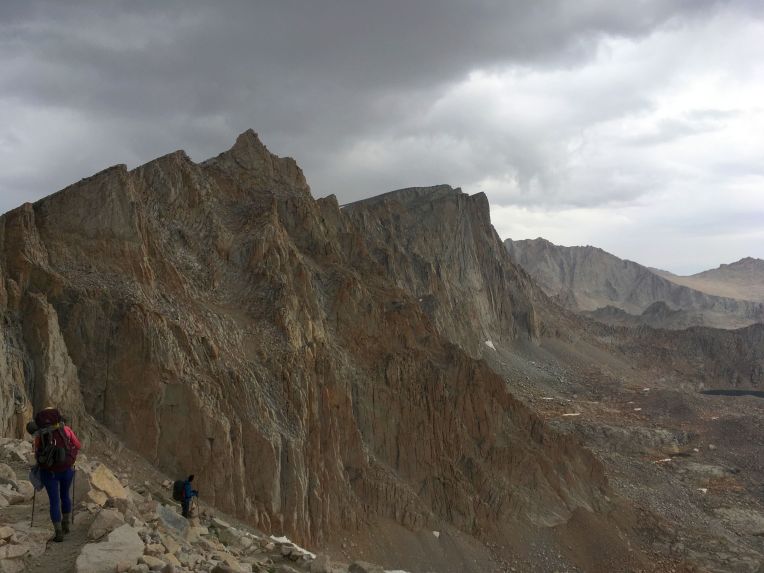
“Wow. I knew today would be hard with the mileage and gain, but it became the worst day in the mountains I have ever had. It started off great. I still felt refreshed from cleaning up the night before, and I felt strong for out two 2000′ climbs and many miles planned for the day. We did pretty well on time, but Justina was having some pain and not feeling great in the heat. Our main objective was Selden Pass, at about 10,900′. We would reach it 14 miles into the day. We labored up the pass and I noticed storm clouds building to the north (behind us). There was one cloud to the southeast of the pass that looked like it could potentially do something, but but we had blue skies ahead on the other side of the pass. We got over it, descended a bit, then stopped to filter water.
 The storm behind us
The skies behind us darkened and we felt a few innocuous raindrops. Justina finished with her water and right when I was about to start, a single hailstone fell in front of us. “Water can wait,” I said as we quickly packed up, laughing at the slight sting of the (pea sized) hail. We headed down and took shelter behind a boulder to wait it out and avoid some of the hail, but then it started hailing harder. And then a bolt of lightning came overhead with nearly simultaneous thunder. We were in a rocky area above treeline – not the place to be with high lightning danger. So we ran. I told Justina we had to get somewhere with multiple trees or cover that wasn’t just rocks and where we weren’t the tallest things. We ran as fast as we could with our heavy packs, thunder crashing overhead, and then the hail got heavier and became marble sized. We stopped at an embankment that could keep us from getting struck by lightning, but no shelter from the hail that continued to pelt us. We turned our backs to the storm as more thunder and lightning came from straight above as we were hit relentlessly with the large hail. Used to quick Colorado storms, we kept waiting for it to let up but instead it continued for nearly 20 minutes. We were beginning to get hypothermic from being completely soaked and hit with what felt like paintballs made of ice. At a break in the lightning, we decided to try to continue down through the hail. The trail was a literal river of 4 inch deep hailstones and freezing water. Our already wet feet were submerged as we finally got relief from the hail. The wet, slushy trail continued for nearly two miles. We changed clothes and socks once we had escaped from the hail fallout.We still had several miles until the MTR cutoff. We were in terrible pain from having to run, shivering, and being battered with hail. We threw down our tents in the first spot we saw, and then Dan walked up, having left early in the morning, speeding over the pass, and avoiding the storm altogether. He helped us get our stuff set up and we planned for the morning. I am still in shock at the extreme danger we were in today. I have never seen a storm so sudden or violent, nor have I ever been in a situation where being hit by lightning had been such a high possibility. The “perfect, dry, no rain” I had heard about the Sierra is apparently not true for us – carefully planning our ascents above treeline is now mandatory. I miss Bill and wish I could talk to him. Hopefully soon.”
The aftermath of the hailstorm (Photo by Justina Yeiser)
7/29/16 – Day 8. MTR cutoff to McClure Meadow: 13 miles, 2100′ gain
“Today was actually a pretty good day. I woke up exhausted from yesterday’s ordeal and headed out to Muir Trail Ranch to collect the resupply. Everything went smoothly and I was able to find some of the items I needed in the hiker buckets (buckets where other through hikers dump unwanted items). There was a laptop available to use the internet ($10 for 15 minutes), but only for email due to very limited bandwidth. Gmail wouldn’t let me sign in to my account without a text verification (no cell service for days) and I couldn’t remember my other email password. I tried logging in to Facebook to send Bill a message. It loaded but would go no further and wouldn’t let me do anything else. I was so frustrated and upset I couldn’t talk to Bill – our SPOT receiver wasn’t working and I had abruptly lost cell service a few days prior. I quickly made a new Gmail address and wrote a sad, probably incomprehensible email but didn’t have time to wait for a response.
 Hiking up into beautiful Kings Canyon
We slogged out of the ranch with our now 45lb again packs, through more shadeless terrain in the heat, trying to get 15 miles but it became apparent that we couldn’t quite make it. We found an excellent campsite in a beautiful valley with a wide creek, deer, and a great view of the sunset. We had dinner and I had the time and energy to make our first fire. We had a nice, relaxing evening. It was just what we needed. Tomorrow will be a big day, going over Muir Pass, but I feel good about it.”


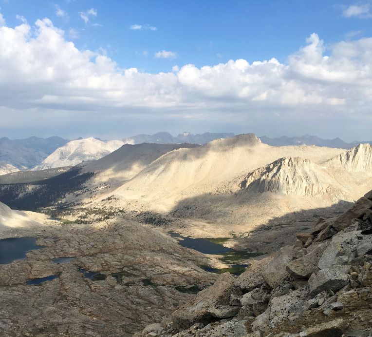
7/30 – Day 9. McClure Meadow to Middle Fork junction: 19 miles, 3400′ gain


Evolution Lake, shelter on Muir Pass
“Today was pretty good. The heavy backpacks made things a lot more difficult and painful, but we are caught up on miles (maybe-1) and optimistic about the next five days! Today was a tough but beautiful climb through Evolution Valley to Muir Pass, with lots of lakes and tarns. It rained on the way up, and I was nervous after the ordeal two days ago, but the clouds never built up or turned electrical. The way down was pretty terrible and rocky. Coming down on the rocks was painful for my feet and ankles. It led us into a beautiful area, though – Le Conte Canyon. We had a bit of trouble finding available camping, but eventually got to a decent spot. Still no cell service. I miss Bill a lot. I keep thinking I’ll get reception on these high mountain passes, but then nothing. Hopefully soon! Another big day up a pass tomorrow.”


 Le Conte Canyon is where this guy lives!
7/31 – Day 10. Middle Fork junction to South Fork Kings Crossing: ~16 miles, 4300′ gain
“Today was another tough day for sure. We had camped low by the river in the bottom of the canyon at 8000′ and woke up with dew all over everything. We waited until the sun finally hit us to dry our tents so we didn’t get started hiking until 9. It was hot, humid, and relentlessly sunny again as we labored up the “Golden Staircase” to Lower Palisade Lake – about 2000 feet. Then we continued up towards Mather Pass, with dark clouds looming over a neighboring valley. We pressed on and finally crested the pass at about 4:30 and headed down. Another day of hiking until after 7 with sore feet, but we had a good dinner and some needed laughs. Tomorrow should be a little better. Hard to believe we only have four hiking days left!”
8/1 – Day 11. South Fork Kings crossing to Baxter Pass junction: ~15 miles, 2600′ gain


“Just another day on the trail. Our day began with a climb up a pass, much easier than the last couple. The trail coming down was shitty and rocky, with 18-24 inch engineered steps that are exhausting to get up and kill your feet and knees on the way down. This makes for much slower going, so we didn’t get as far today as we had hoped. We are, however, camped exactly 50 miles from the end of the trail! That doesn’t seem like much at all, but we still have a few challenges left for the next three days.”


A cool suspension bridge
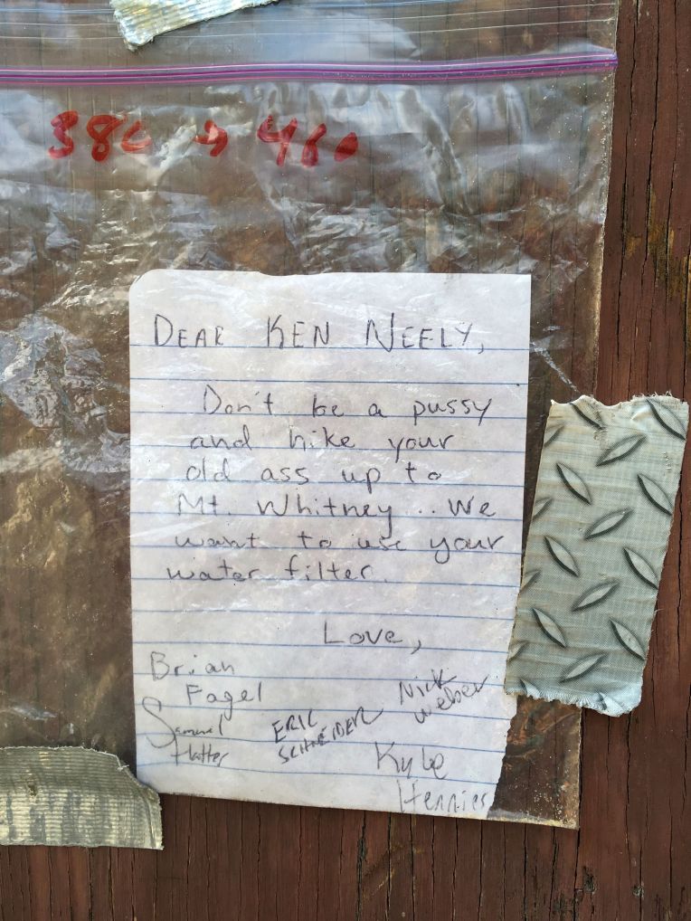 One of the better notes we saw along the way, haha
8/2 – Day 12. Near Baxter Pass junction to below Forester Pass~16 miles, 3700′ gain


Fin Dome and the scenery on the way to Glen Pass
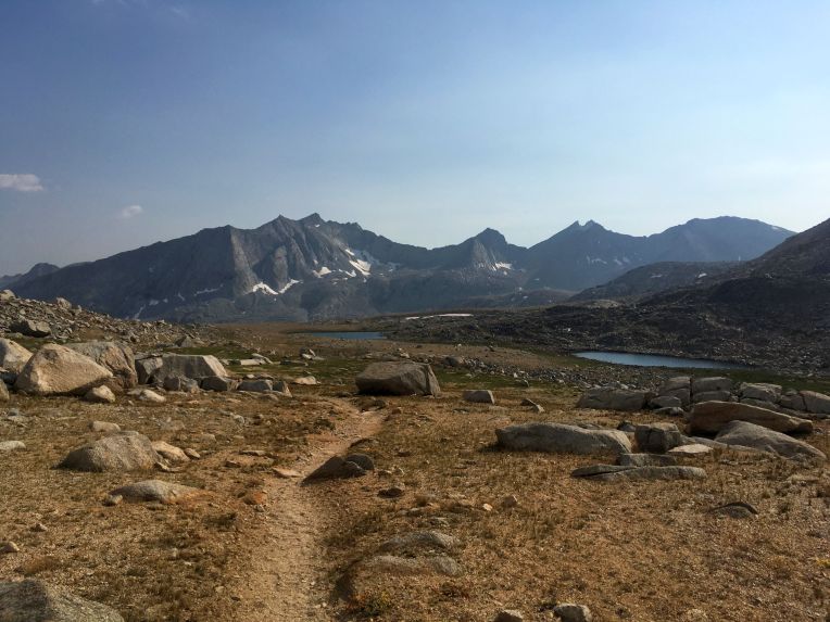
“Today was a pretty good day. Backpack is lighter and my legs feel strong. We saw many beautiful lakes and jagged peaks today as we went over Glen Pass. We then headed up the valley towards Forester Pass, our last major objective before Whitney. We got up to over 11,000′ so it’s a chilly evening, but tomorrow will be much easier for it. Hard to believe we only have two days left!”


8/3 – Day 13. Below Forester Pass to Guitar Lake: 19 miles, 3900′ gain


“Just like I thought it would, the end of this hike came very quickly. We went over Forester Pass this morning, and a guy with a satellite phone let me use it to text Bill. I was finally able to tell him that we are on schedule for a 10am summit tomorrow, so hopefully they can coordinate. The rest of the day was pretty uneventful. We got rained on for a bit, and pushed through the miles to get to Guitar Lake. We set up camp, saw a great sunset, and are ready to hit the trail at 6am. I am so excited to see Bill! Mixed emotions about the hike being over, but I have a lot to look forward to.”
 Sunset behind Guitar Lake
8/4 – Day 14. Guitar Lake to Whitney Portal: 15 miles, 3300′ gain 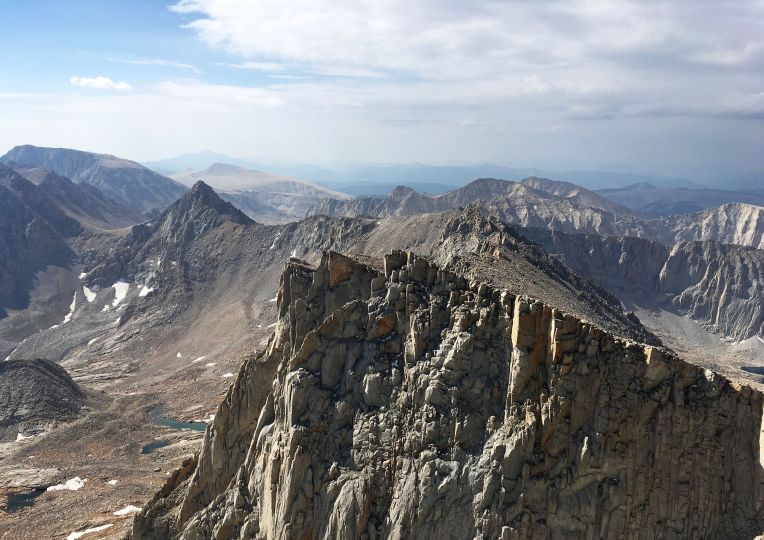
The alarm went off at 5am and I awoke to one of the worst sounds possible – pouring rain hitting my tent. “Are you FUCKING kidding me?” I yelled into the darkness. I remembered vividly having to pack up my things in the rain and hike with a waterlogged tent and backpack for so many days on the Colorado Trail. Cool, we came all this way and hiked 200 miles and now we may not even summit. How typical of my luck. I angrily started putting my stuff away, steeling myself for a miserable day of hiking and wondering if it would be safe or even possible to summit. We grumbled to each other from our tents. At about 5:45, the rain slowed and then stopped. I poked my head out of my tent and saw the sky beginning to clear. We got up and started getting ready. A chilly but dry wind helped dry off our rain flies, and we packed up and got on the trail at 7. We would be cutting it close with our planned 10am summit, as we had 5 miles and about 3000 feet to reach it. I hoped everything would go ok to meet up with Bill and Annalise! Justina wanted to pace herself and Dan and I were feeling strong, so we split up as we climbed higher and higher above Guitar Lake.
 That lake really does look like a guitar
Three miles in, we reached the trail junction between the JMT and the Mt. Whitney trail. We had a quick snack, chatted with a few people, and then began the final summit push. Despite wearing our full packs, we blew past day hikers who at that point had already done 9 or more miles and about 5000′ of elevation gain. Dan and I reached the summit at 9:50 – we couldn’t believe it! Delayed by and hour and we still killed it. We took some photos and hung out on the summit, and Justina arrived no more than ten minutes later. We relaxed and took more photos, waiting for Annalise and Bill to appear. I still didn’t have reception, but somehow a single text message came through around 10:20, and it was Annalise telling me she was at about 13,800 with Bill not too far behind. She was on the summit by 11 and told me that Bill had been having some tendinitis pain. After 20-25 minutes, I was starting to get nervous when I finally saw a familiar red jacket coming up Whitney’s broad summit. We hugged, drank shooters of Fireball, posed for a few last pictures, and then hurried off the summit as light graupel began to fall.


The hike down was pretty uneventful, although at the trail junction we encountered a very clever marmot who hangs out where people leave their backpacks, not wanting to carry the weight to the summit. The marmot knew how to open zipper pockets and we watched him go through people’s trash and eat what looked to be an entire Clif bar. We descended the LONG and unfamiliar trail. dealing with a bit more rain and graupel along the way. We reached the Whitney Portal trailhead at 5:30, took a few victory photos, loaded into the rental car, and just like that the hike was over.
 Justina and Dan descending the 99 switchbacks, with Mt. Muir and Whitney above


Final Thoughts
This hike was hard. I underestimated the immediate elevation gain and difficulty of the trail. I would certainly advise others to take more than 14 days – maybe 18-21 for a more relaxing, enjoyable experience. The Sierra Nevada is a stunning mountain range, and its jagged white granite peaks and crystal blue lakes were like nothing I had ever seen. I had high expectations after doing the Colorado Trail, and I must admit that there are things about the JMT I found to be a bit disappointing. The heat, lack of shade, dryness, and dusty/sandy/rocky/slabby trail made for some unpleasant hiking. The scenery was gorgeous, but I found myself comparing the best parts to my favorite parts of the Colorado Trail and ultimately I think the CT is more beautiful overall. I was also disappointed by the trail culture (or lack thereof). It didn’t seem like other hikers were interested in meeting people, and we even heard from a dad/daughter team that two rude women didn’t allow them to share a 5-tent group site! There were plenty of people with no trail etiquette, and sadly we saw a lot of evidence of hikers failing to observe LNT principles. I am impressed with California’s permit system, as things could clearly be much worse.
Am I glad I did it? Hell yes! Despite the difficulties and tight schedule, it was an incredible hike. I have been asked what was the best part. I thought about all the scenery and looked back at my photos, trying to pick my favorite moments, but then I realized that the best parts weren’t and couldn’t be captured by photos. The best parts were sitting down after a long, tough day and still laughing uncontrollably over dinner or a campfire. It was making up elaborate back stories about squirrels, embracing the suck and making fun of ourselves, and Dan going through people’s trash to surprise us with needed items. It was the three of us working as a team and being there for each other when we all needed it. And it was just being out there because we have a deep love for hiking, the mountains, and finding pieces of yourself in nature. There is something very pure about through hiking – waking up and going to sleep in the wilderness day after day, seeing new things with each mile, and carrying your whole life in a backpack. As said by John Muir himself, “In every walk with nature, one receives far more than he seeks.”

Very nice journal. My friend and I took our time so we didn’t have to rush. It was a great hike. Colorado is on the To-do List.
LikeLike
Very cool trip report! What an adventure for you all. I’m impressed with the mileage and vert you all achieved every day.
LikeLiked by 1 person
Do you think that you would feel differently about the trail if you had taken more time to relax and enjoy it? Did you ever stop to go swimming or fishing? or Just hang out for a while?
LikeLike
That probably would have helped. I had no idea that swimming would be so popular! We did take plenty of nice breaks, but a slower pace and more flexibility likely would have made it more enjoyable. But since I had to choose between a blistering pace or not doing it at all, I still have no regrets! I’d like to return someday for a more leisurely hike.
LikeLike
Great Jurnel and sounds lke quite the journey!
LikeLike
Loved reading these mems! So excited for our travels this autumn!
LikeLike