Mount Tyndall & Mount Williamson via Shepherd Pass

Day 1 (Hike in + Tyndall): 7/15/2018
Mileage: 17.4
Elevation Gain: 9,800′

Strava Track:

Screen Shot 2018-07-27 at 7.55.32 PM

We arrived at the trailhead the evening of the 14th and car camped, knowing that we needed to start early the next day to  avoid hiking in the desert heat. This trailhead is another that starts pretty much at the valley floor. We woke up, put on our overnight packs, and got on the trail at 3:30. The trail quickly crosses Symmes Creek 4 times and then starts up 54 switchbacks through the forest. The sun came up right as we got to Symmes Saddle, an area where you begin a disheartening 500′ descent. The trail continues through scrub and sparse trees until finally reaching a forested area and Anvil Camp, where some people choose to stay overnight. We did not have this opportunity since this would be such a quick trip with a lot to accomplish. It was pretty buggy too, but also the last good place to fill up water for a while.

The trail breaks out of the trees and continues for quite a ways through rocks before Shepherd Pass comes into view, over 10 miles into the hike. During the record snow year of 2016-2017, a small herd of mule deer got stuck coming down the pass in a migration gone wrong and their rotting carcasses now litter the trail in a few places. I was slightly prepared for this, but it was really bad. There are a few further down, and then a bunch near the bottom of the switchbacks, possibly caught in an avalanche. It’s rancid. We hurried through this area and to the top of the pass. We entered into Sequoia/King’s Canyon and enjoyed the impressive view to the west. We then left the trail and turned left towards Williamson Bowl to set up camp.

IMG_9476

IMG_9494
The pile of carcasses 😦

IMG_9495

We took a not so efficient route towards where we assumed the bowl would open up, and followed a somewhat confusing talus hop down towards the ridge that goes through the center of the bowl. There are several gorgeous blue lakes in here, but you would have to descend quite a ways to camp near them so we found a few nice flat pads on rock slabs just below the left side of the ridge. We set up camp, tried to nap in the hot midday sun, and then decided it was time to go up Tyndall. We had originally planned on having two nights here so we wouldn’t have to do the approach hike and summit in the same day, but no such luck.

IMG_9477Mount Tyndall’s impressive north face above a crystal blue lake

I had a guidebook that recommended taking Mount Tyndall’s long northwest ridge, so we did. Do not do this. It is a waste of time and effort for nothing but talus and boulder hopping. The ascent took forever. We finally summited and we were exhausted! We looked over at hulking Mount Williamson and thought it looked unclimbable, but decided that we would reevaluate the next morning.

IMG_9478How the heck do you get up this beast?!

We descended down the obvious rock rib on the northeast face, which was fine. Easy class 3 with some tippy talus, but nothing that was too bad. We got back to camp just in time to watch an incredible sunset behind Tyndall, and as we ate dinner I saw a fiery green shooting star in the twilight sky. It was a nice end to a tough day. We went to bed and set the alarm for the next day’s climb.

IMG_9659

Relive Topo/GPS

Day 2 (Williamson + hike out): 7/16/2018
Mileage: 16.2
Elevation Gain: 3,800′

Strava Track:

Screen Shot 2018-07-27 at 7.57.20 PM

The alarm went off early, but we decided to snooze and await the sun. We were exhausted from the day before. We headed out at 6 and walked along the ridge crest through the Williamson Bowl. I don’t have a good photo of the route, since you can’t really see it from Tyndall or elsewhere in the Bowl. Follow occasional cairns through some ups and downs on a path of least resistance towards the base of Williamson’s massive west face. Do not try to cut up too soon or you will face a scree and talus nightmare. Once at the base, look up and see an area of rocks stained black from water. This is your approximate goal. Head up the talus, around and over the black stain, and up a gully that is the easiest way up the west face. There are cairns and signs of previous travel through here. It’s a bit loose in places but not too steep.

img_9729At the top of the chimney

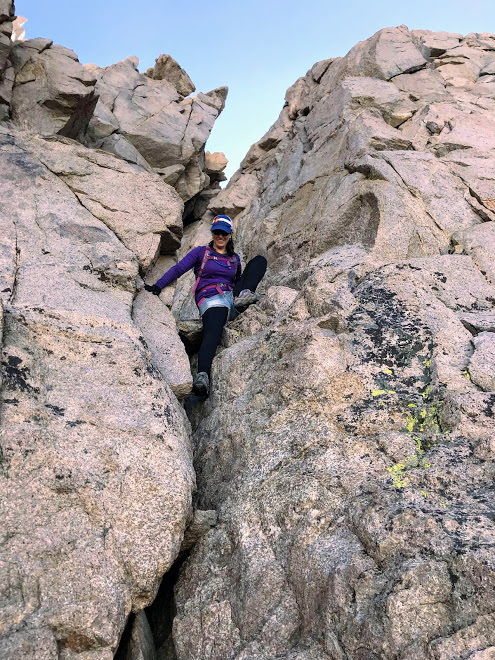
Eventually you will reach the base of a chimney to the upper right. This is the crux of the climb. It’s definitely California class 3! Work your way up the chimney on good, featured granite and then top out on the left. Here you will see a plateau the size of a football field with Williamson’s sub summit to the east. Walk along the right side of the plateau and rock hop up the right onto the summit ridge. Take in the views and marvel at how small Mount Tyndall looks from its 14,375′ neighbor!


IMG_9486Tiny Tyndall and much of the route seen from the summit

IMG_9500
Descending the chimney

It was a beautiful sunny day and we enjoyed hanging out on the summit for a while before descending. We made pretty quick work of the gully on the way down, got back to camp, broke down, and hiked out. We took a more efficient way out to Shepherd Pass, hurried past the deer, and labored up the 500′ to Symmes Saddle. It felt good to be past that in the afternoon heat. We got through the 54 switchbacks, crossed the creek, and couldn’t have been happier when we saw the car at 5:30. This is not a trip for the faint of heart, and I would definitely recommend doing it over 3 days if you have the time. We had another motel room for the night, so we raced down to Lone Pine and had a fabulous dinner at Merry Go Round and tended to our blisters before bed. We had another full rest day the next day, which we would need to recover and get ready for our final endeavor of the trip – Whitney and Muir.

Relive Topo/GPS

Mount Langley

Date: 7/13/2018
Mileage: 22.6
Elevation Gain: 4,950′

Strava Track:
Screen Shot 2018-07-27 at 7.54.24 PM

We drove up to the Cottonwood Lakes/Mt. Langley trailhead on the evening of July 12. There are a number of tent sites, vault toilets, and quite a bit of parking. It seemed a little busy so we continued up the road to Horseshoe Meadows, which has more tent sites for $6 a night. We found a nice one and retreated to the car as a heavy thunderstorm passed over the area. It poured rain for about 30 minutes, let up, started again for about 10 more, and then finally cleared. It seemed like most of the other campers were also hiking or climbing, so after we ate dinner and it got dark it was pretty quiet. We set the alarm for 4 so we could get started right at 5.

We awoke to clear skies, packed up the car and drove to the trailhead. We got feet on the ground at 4:59am. The trail is excellent, easy to follow, and never steep. It goes through a gravely area with old dead trees, pine forest as it flanks a creek, and then turns to the west and splits to New Army Pass (to the left) and Old Army Pass (to the right) with gorgeous meadows and numerous lakes. We opted to take New Army Pass, since we had heard conflicting information about the conditions and safety of Old Army. Once up and over a small bump, one of the larger lakes and Langley’s impressive south face come into view. It’s a great place to take a break and get some photos. The trail continues on past interesting rock features, bristlecone pines, and more tarns as it climbs past timberline.

img_9412

The trail up to New Army Pass is excellent. It consists of gentle, uniform switchbacks. We got to the top, saw the rest of the route (there is still quite a bit!), and took another small break. There were numerous marmots sounding the alarm, and with good reason – two coyotes gained the ridge from the other side! I had never seen a coyote up so high before. The trail meanders across a broad plateau, and we saw where the trail met up with Old Army Pass. We ran into two guys who said they had come up New and were going down Old, and we decided that would be a good plan since it would save us about a mile.

IMG_9398Spot the coyote!

We followed the obvious trail to the north and got to the base of Langley’s summit plateau. It is still a ways away. We followed large cairns through mostly gravel trail and a bit of rock hopping as we gradually made our way up. You really aren’t there until you’re there! By this point, clouds and fog had descended on the area, but we were keeping an eye out for signs of electricity. The large cairns continue on the broad plateau and we finally reached the summit. At this point the summit was completely socked in, which is disappointing considering that I could tell that the drop off to the north and view of neighboring peaks Muir, Whitney, and Russell would be dramatic. We took some photos and it began to lightly graupel as we began our descent. We got to the trail junction and started down Old Army Pass.

IMG_5260
Those views! 👌🏼 😩

The trail is not maintained, and there is a persistent snowfield across part of it, but it’s pretty easily avoidable. There are much more eroded trails on some of Colorado’s 14ers, so if you’ve done a fair bit of hiking you’ll be fine. We continued down the switchbacks, enjoying the great close up view of Langley’s south face and one of the larger Cottonwood lakes below. Once off the switchbacks, the trail returns to easy dirt and gravel. It goes past more bristlecone and alpine meadows.

Descending the switchbacks, and looking back up at Old Army

I’m really glad we did this semi loop because both sides have their own beauty. The sun came out as we hiked out and we took a last look at Langley before descending back into the forest. Before too long, we met up with the main trail and slogged out. It was a long day and we were originally going to backpack in, but due to the fire changing our plans we needed to do it as a day hike. I’m glad, because those trail miles go really quickly. We clocked 22.6 miles in just over 10 hours. However, the area is absolutely incredible and I would love to return to spend some more time there and do a repeat of Langley so I could enjoy the summit views!

We got back to the car and drove to Bishop for our first night in a motel for almost a week. Showers, sushi dinner for Sommer’s birthday, and beds were a nice change of pace. The next day was a full rest day, so we picked up permits, soaked in the hot springs, and then drove out to the Shepherd Pass trailhead to camp the night before our next big adventure – Williamson and Tyndall.

Relive 3D Topo/GPS:

Middle Palisade – NE Face via Brainerd Lake

Date: 7/11/2018
Mileage: 16.1
Elevation Gain: 7,400

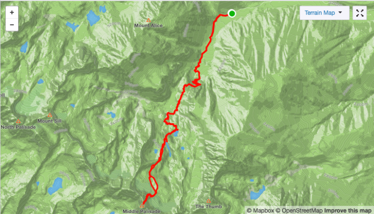
Strava Track:

Screen Shot 2018-07-27 at 7.52.36 PM

After getting our asses kicked on Split Mountain, we discovered that the fire we had observed over the last two days had closed access to not only the Whitney Portal area, but also Shepherd Pass, the location of our next objective. We went into Bishop and looked at my woefully inadequate guidebook to see if there was a different peak we could work in instead. We settled on Middle Palisade, which can be accessed from the east via the Glacier Lodge/South Fork of Big Pine Creek trail.

img_9342Middle Pal and Norman Clyde from the trail

We got on the trail just before 7 and were immediately impressed with the well maintained, well marked trail. We were making excellent time compared to our previous approach! This enthusiasm was short-lived. Less than 2 miles in, we reached a creek crossing. There was no bridge, no log, and no place to cross that was shallower than hip deep, rushing water. All three of us being of short stature quickly decided that wading across would not be safe. We went up and down the side of the creek and bashed through thick willows looking for any rocks, logs, or shallow areas while being eaten alive by mosquitoes. Finally we went 100 yards or so to the right of the trail and found a series of shallower areas with branches that allowed for an adventurous and foot soaking crossing. We rejoined the trail and continued on our way.


Switchbacks lead up and over a headwall and pass, then the trail descends into an area best described as ‘mosquito apocalypse’. This is a lush area near the junction of the Brainerd Lake trail and the trail to Willow Lake, which was allegedly even worse for mosquitoes. We tried to hurry through the area while also being confused about our mileage. We were using an AllTrails track that said the hike to Brainerd Lake is 7.4 miles round trip, so when we had hiked over 3.7 miles we knew that wasn’t the case. Do NOT trust California route descriptions!


We arrived at the lake at about 10. The lake is 5 miles from the trailhead. It is also just as much of a mosquito apocalypse as the lower section. Not knowing any better, we set up our tents in a not so great site and retreated a while for a rest and break from being devoured. It looked like it was going to storm again, but instead it just got very hot. We stupidly decided to make another afternoon summit bid. It was about 1pm and we decided we’d rather have to only hike out in the morning, so we headed for Middle Pal.


img_93451Gorgeous blue water in Finger Lake

There is a cairned trail at the NW end of the lake that takes you up to Finger Lake, which is gorgeous and has many far better campsites. It also seemed less buggy. So I would definitely recommend taking the extra few minutes to get above Brainerd. The trail will take you to the end of the lake on the left side; cross to the right over some boulders at the lake’s outflow to begin ascending towards the glacier. Follow cairns as you continue south over a higher, rocky area. Aim for the cleft between the Palisade and Middle Palisade glaciers. You will now see the east face of Middle Pal.

img_9733Near the entrance to the gully

Supposedly there is an entrance to the class 3 east face here, but we had a photo that was taken from Thunderbolt Peak and not the top of the Middle Palisade glacier, making it difficult to discern rock features relative to snow level, etc. We saw a line up a gully of red and white crumbly rock, which then led up to the left to more solid rock and a good ledge system. The climb up the face/gully is long but not bad and not super exposed. In retrospect, I’m not 100% sure it wasn’t the east face. Either way, we continued up a pretty obvious route and topped out just below the summit block. We went around the left side and scrambled up large blocks to the summit.

img_9359-pano

The Palisades are truly breathtaking. I had seen them from a distance from the JMT and from the approach, but their small, dramatic summits are best appreciated from up close. We spent a few minutes enjoying the views and then headed down. The descent down the face wasn’t as bad as expected, and once back on the glacier we made quick work of the sun cupped snow. We found the cairned route through the boulders, past Finger Lake, and back towards camp as darkness fell. We fell asleep quickly.

The hike out was uneventful although the mosquitos seemed much worse than the day before. Knowing the way across the creek, we got through much more quickly. We enjoyed the easy hiking on good trail and were back to the car in no time. We drove back into the valley, went for a soak in the hot springs, and then headed up to Horseshoe Meadows to get some rest for the next day’s objective, Mount Langley.

Relive 3D Topo/GPS


Split Mountain via Red Lake

Date: 7/9/2018
Mileage: 12.7
Elevation Gain: 7,725′

Strava track:

Screen Shot 2018-07-27 at 7.51.23 PM

After getting our permit at the White Mountain ranger station in Bishop, we followed the mostly accurate directions to the trailhead that we received from the ranger. We were told that as of summer 2017, part of the road had been completely washed out by a creek from heavy snowmelt about 4 miles from the trailhead, but there “might” be a culvert. The dirt road was a little bumpy and rutted at times, but our Toyota Rav4 did fine just being careful in a few spots Any vehicle with comparable or greater clearance can do it. Fortunately, the dreaded creek crossing had indeed been repaired and a culvert placed, so we were able to drive all the way to the trailhead. This is where the USFS’ directions are no longer helpful.

There is a parking area with a trailhead sign/kiosk near the entrance of the canyon you will be hiking up, but this is not the actual trailhead. There is a very rutted out “road” that goes south towards the canyon and a social trail at the end of it, but this is NOT the trail! Turn around and walk to the north up a spur road that dead ends where the trail begins. The trail in this area switches back through sand and brush. You may lose it at times, but it reappears as you work your way up the hillside. Finally it rounds the shoulder and into the canyon.

IMG_9260

The hike to Red Lake basically begins at the valley floor, in desert scrubland. It is VERY hot and dusty, and there is absolutely no shade. A very early start is recommended. This is the hike where we started using the term “Sierra mile,” because there was no way we had only hiked a mile and a half so far!?

Continue to contour along the north side of the canyon on the increasingly overgrown trail. There is steep dirt, bushwhacking, and lots of elevation gain as the trail gradually turns toward the northwest.

IMG_9737
Yep, that’s the “trail” here

The landscape eventually transitions from scrubland to subalpine and the trail moderately improves. Ascend a headwall through bristlecone pines and then follow trail segments as you continue northwest past a lake on your left. Occasional cairns through boulders will get you to the spectacular Red Lake, which has several very nice campsites. According to my Strava, the lake is 4.4 miles from the trailhead. The lake is great for a cold, refreshing swim as a reward for the hot, dusty hike in.

Snapseed (25)

We set up camp and went for a dip as some dark clouds came in. We retreated to our tents and napped as a few heavy thunderstorms moved through the area. The storms subsided and, thinking the rest of the climb would be much shorter than it actually was, started heading for the summit around 3.

Hike around the lake towards the inflow. Your eventual goal is just left of the lowest point on the saddle between Split and Prater. Follow trail segments and occasional cairns through grass and talus as you hike due west.

IMG_9252
Looking back on the route above the lake

We encountered a large, soft snowfield here and ascended climber’s right of the rocks through the center. Scramble up boulders and scree above the snow and head towards the obvious U-notch, but turn left just before it and continue up and to the left. img_9889
Photo courtesy of Mark Nolan

IMG_9245
Erik topping out on the saddle, with the snowfield below

Now the rest of the route is mostly in view. Work your way up tedious talus and before too long, you can enjoy what may be one of the best summit views to be had in the area. We summited just before 7 and knew we would be getting back to camp in the dark, but the scenery was well worth a short break to take photos and take in the dramatic surrounding peaks.

DSC03338
A smoky view from the summit

We descended the way we came, made it back to camp just after 9, and had dinner. We awoke early the next morning, took a few final photos of Red Lake, and left around 8 to try to beat the desert heat on the way out. We did not. This was a tough one! Next up, Middle Palisade.

Relive 3D Topo & GPS:


CA 14ers Road Trip: White Mountain Peak

From July 8 – 19, my two partners and I drove from Denver to the Owens Valley area to do a 14ers bender of 8 peaks in 12 days. That journey began on White Mountain Peak, a desert peak not far from the Nevada border.

Date: 7/8/2018
Mileage: 14.9
Elevation Gain: 3,205′

White Mountain Peak (14,246) is by far the least difficult of the California 14ers, and it made for a nice warmup for the unknown horrors that would await us in the Eastern Sierra over the following days. It is accessed via a long washboard dirt road that goes through the Ancient Bristlecone Pine Forest area. We arrived at the trailhead just before 11pm after driving since 5am. There were 8-10 other vehicles at the trailhead, but we had plenty of room to throw down a tent and crash for our early wake up.

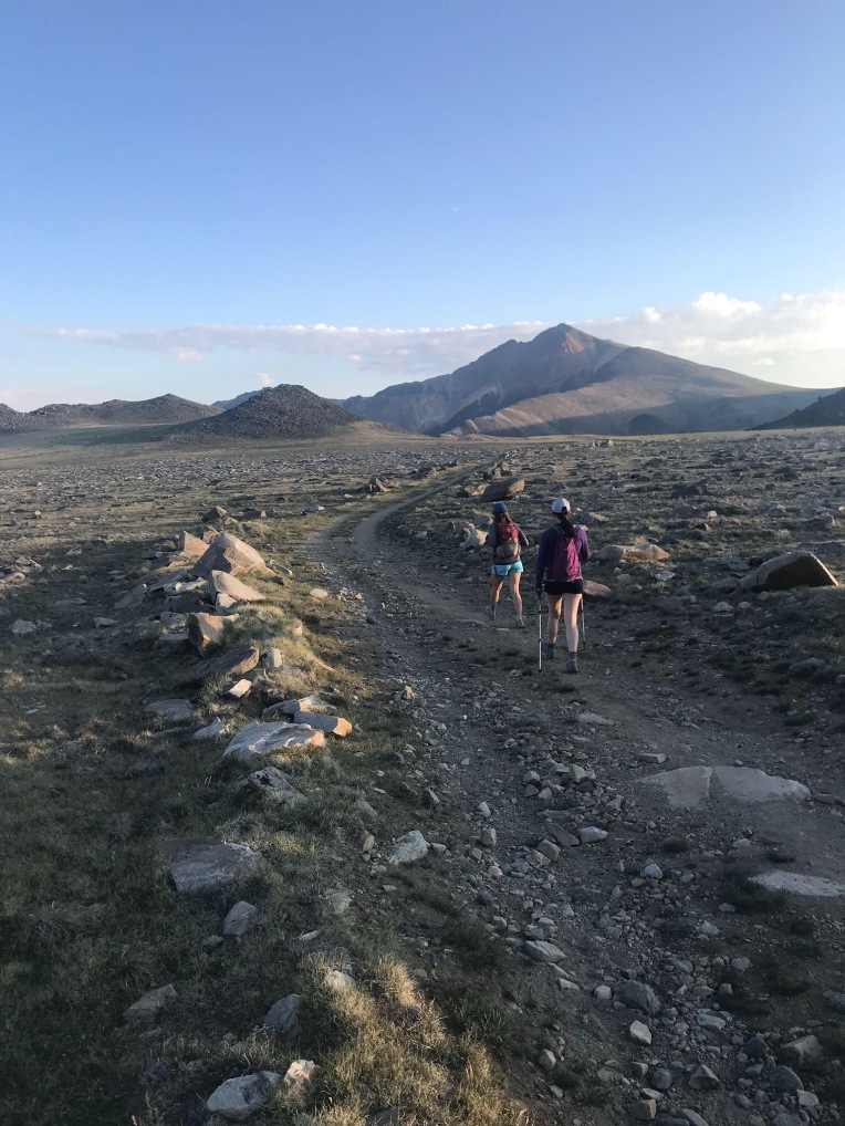
We got on the trail (which is a dirt road the entire way) just after 5 and made pretty good time up the gentle grade past the Barcroft research station and observatory. From here, the summit comes into view. It’s still a ways away, but it’s all just easy road walking.

IMG_9886

We summited around 9:30, hung out and took photos for a while, and started our descent at 10:00. We got back to the car right about 12:30. If you’re looking for a much more detailed route description and photos, look here.

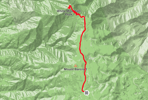
Strava track:

Screen Shot 2018-07-27 at 7.58.00 PM

The drive out was MUCH more interesting in the daylight; the bristlecone pine forest really is a thing of beauty. It’s completely different from any landscape in Colorado! We continued out of the area and into Bishop to pick up our permits for our next objective, Split Mountain.

Relive 3D Topo/GPS:

The John Muir Trail

About six months ago, I received a text in a group chat I had with Tony, Dan and Kate who I met on the Colorado Trail last year. It was Dan, saying that he had won the lottery for four JMT permits with a start date of July 22! I was elated – the John Muir Trail was high on my list, but I had not been pursuing a permit because of the hassle and 97% denial rate. Kate knew right away that she couldn’t join us because of a cool work opportunity. Then I checked my calendar and remembered that I had to be in Newport, Oregon on August 5th for my grandmother’s birthday party with the whole family. My elation crumbled. How could I turn down what may be the hike of a lifetime? But hiking the JMT takes 3 weeks! Or does it? I did the math – I would have exactly 14 days to complete ~221 miles and nearly 47,000 feet of elevation gain. I mulled it over and asked Tony and Dan if they were ok with a pretty aggressive pace and they agreed! I also suggested that the fourth permit spot should go to my friend Justina – she and I have a similar story and passion for the outdoors. She had mentioned wanting to do the JMT someday so I offered it to her and she accepted!

Months went by; I did some planning, but felt prepared after last year’s hike. I dehydrated food, mailed my resupply bucket, and secured a ride from the Fresno airport to Yosemite National Park with my awesome aunt. Shortly before we were set to leave, Tony accepted a great new job that started during the hike so he could no longer come. Quite suddenly, it was the day before we flew out and of course we still had a lot to do. Justina came over and we packed and prepared until after midnight, then woke up at 4:30 to head to the airport. Bill dropped us off, and we were on our way! After a short layover in Phoenix, we landed in Fresno and were almost immediately greeted by my aunt Leslie. We collected our bags, picked up a few last minute items and began the 2 hour drive to Yosemite.

It’s true what they say about Yosemite Valley – pictures do it no justice. We caught our first glimpse of Half Dome, then saw a few waterfalls and El Capitan. A return visit to the Valley is definitely in the future. We headed towards the backpackers’ campground and I started wondering how we would find Dan, then a moment later my phone rang and the caller ID said “Yosemite National Park”! Sure enough, it was Dan calling from a pay phone. We parked, met up with him, finished packing up, and said goodbye to Leslie and thanked her profusely for the ride! We set up camp, ate a quick dinner, and went to bed early for the next day’s hike.

IMG_1486Unfortunately, the trail doesn’t actually begin here.

7/22/16 – Day 1. Yosemite Valley to Forsyth Trail junction: ~10 miles, 4200′ gain

“Today was tough, as the first day always is. We left the backpackers’ camp around 9 am. We had about a mile walk to the official trailhead, went to the wrong trailhead, and then finally began a beautiful but brutally hot climb out of the valley. The crowded trail took us past two waterfalls, and we had great view’s of Yosemite’s famous granite walls.

IMG_1503Nevada Falls

Eventually we started to see fewer people, and the trail turned into a fine dust. This unfortunately bonded with the layers of sweat, sunscreen, and DEET on my skin to form an impenetrable layer of sticky dirt. It will not come off with baby wipes, water, anything. So it has been an uncomfortable evening. We didn’t get nearly as far as we wanted today, but the heat and relentless elevation gain plus 45 pound backpacks made for a very long and difficult hike. We set up camp in a large burn scar next to another group, ate dinner, and expect to have a better day tomorrow. Spirits and stoke are high and all three of us are doing very well considering the punishing circumstances of today as a first day. Tomorrow should bring more gorgeous scenery and easier hiking.”

7/23/16 – Day 2. Forsyth Trail junction to Tuolumne Meadows: ~14.5 miles, 3200′ gain

IMG_1524Keeping it gangsta. There were a LOT of bugs!

“Unfortunately, today wasn’t that much easier. Almost all of today was still hot and mostly not shaded. The heat and extremely dusty, sandy trail gave me painful blisters on my toes (expected) and heels (unexpected). Hopefully I can power through it because we have to start making up miles. This morning did have some nice final views of Yosemite Valley, our first look at some high Sierra peaks, and some amazing meadows and lakes. I am excited to get out of the park so it starts to feel more wild. Tonight we had to stop at Toulumne Meadows and pay for a spot at the backpackers camp. People are being very loud, even at 10 pm. That should change tomorrow – we are trying for about 16 miles and will go over Donohue Pass. Flat at first and then a final climb to the pass. Hopefully we will start getting our legs soon.”

IMG_1540Cathedral Peak 

7/24/16 – Day 3. Tuolumne Meadows to Marie Lakes junction: ~16 miles, 3300′ gain

OLYMPUS DIGITAL CAMERA
Lyell Peak and neighbors

“We are definitely improving. Today started out pretty mellow, with a long hike along a meadow and the Lyell Fork of the Tuolumne River. The water was clear and enticing. After about 9 miles of mostly flat but sandy and non shaded hiking, we began our ascent to Donohue Pass. It was hot and grueling, but beautiful. Alpine lakes, wildflowers, and jagged, snow-covered peaks began to appear.

We reached the pass (11,060′) around 5 and chatted with some northbound PCT hikers, then headed down into increasingly lovely terrain. An incredible watershed with many lakes and small streams led us back into the forest, where we set up camp. We will need more days like today in order to catch up on our miles. I can’t wait to see what lies ahead!”

7/25/16 – Day 4. Marie Lakes junction to Minaret Creek junction: ~14 miles, 2600′ gain

IMG_1588

“Ouch! The first four days have been very tough! The heat, sun, bugs, and steep terrain are worth it for the views, though. Spectacular scenery today of dramatic peaks, many clear blue lakes, flowers and cascading creeks. We laugh through the difficulty and pain. We are a good team and I am confident and eager to continue!”

I wish I had written more about this day, because the views were truly incredible. From Island Pass, we began seeing the stunning Banner and Ritter Peaks, above the very blue Thousand Island Lake. We hiked through forest past several more beautiful lakes, up what seemed like over 50 switchbacks, and found a great but buggy campsite.

OLYMPUS DIGITAL CAMERA
I couldn’t stop taking pictures.

7/26/16 – Day 5. Minaret Creek junction to Purple Lake: ~20 miles, 3000′ gain

IMG_1624

“Today was fucking awful. It was a terrible, horrible, no good, very bad day of hiking. Let me count the things that made it suck: My water filter is clogged from shitty lake water and needs to be backflushed, but I am missing the piece to do it so I am stuck having to pump water with extreme difficulty. Another day of near 90 degree temperatures with maybe 10% shade. Boring scenery for miles. The FUCKING flies! I have never experienced anything so awful. They would swarm around my head even while hiking, and if I stopped for even a few seconds they would be all over me (10 or more). I would be painstakingly filtering water, using both hands, and flies flies would be all. over. me. Oh and then I lost my balance in a creek crossing and fell, getting both of my shoes wet. While I changed socks, of course, I was swarmed with flies. If every day was like today, I would be so fucking done. However, we did start getting some pretty great views towards the end of the day. The next two days will be tough since we are still trying to make up miles, but then hopefully it will get better. I’m having some pretty bad pain. Nine days to go.”

IMG_1632

7/27/16 – Day 6. Purple Lake to Lake Edison junction: ~16 miles, 2300′ gain

IMG_1646Fake it til you make it!

“I thought today would be pretty terrible. I woke up in a bad mood, sore from yesterday and not excited for more hiking. My feet hurt a lot. The day started with a climb out from Purple Lake, then to the impossibly blue Lake Virginia, then down, then back up 1600 feet to Silver Pass. It was difficult, but the views were fantastic. A scenic death march, I thought to myself. Still not much shade, and I burned my legs from wearing shorts and long sleeves to protect my arms. Dan was far ahead as usual, and Justina and I suffered through a 3000′ descent on a rough, rocky trail. Still flies. We saw a SAR helicopter flying up through the canyon and circle a few times to eventually land in a meadow to evacuate a girl who was sick. Our feet and legs hurt more with every step as we trudged through forest looking for our final landmark/trail junction. We crossed a bridge and saw Dan at the edge of a very cold, easily accessible river. It was just before 6, and we were actually able to do laundry and wash ourselves as well as we could. It felt incredible. All the heat, filth, sweat, etc. from the last six days were washed away in the brisk water of Mono Creek. We dried off, made dinner, and planned the next two days. Tomorrow will certainly be tough – 20 miles to the Muir Trail Ranch for our resupply. I feel so much better after cleaning up today. I know we can do it! One week until Whitney!”

IMG_1661Near Silver Pass

7/28/16 – Day 7. Lake Edison junction to MTR cutoff: 21 miles, 4300′ gain

IMG_1667Justina wades across a creek crossing 

“Wow. I knew today would be hard with the mileage and gain, but it became the worst day in the mountains I have ever had. It started off great. I still felt refreshed from cleaning up the night before, and I felt strong for out two 2000′ climbs and many miles planned for the day. We did pretty well on time, but Justina was having some pain and not feeling great in the heat. Our main objective was Selden Pass, at about 10,900′. We would reach it 14 miles into the day. We labored up the pass and I noticed storm clouds building to the north (behind us). There was one cloud to the southeast of the pass that looked like it could  potentially do something, but but we had blue skies ahead on the other side of the pass. We got over it, descended a bit, then stopped to filter water.

IMG_1669The storm behind us

The skies behind us darkened and we felt a few innocuous raindrops. Justina finished with her water and right when I was about to start, a single hailstone fell in front of us. “Water can wait,” I said as we quickly packed up, laughing at the slight sting of the (pea sized) hail. We headed down and took shelter behind a boulder to wait it out and avoid some of the hail, but then it started hailing harder. And then a bolt of lightning came overhead with nearly simultaneous thunder. We were in a rocky area above treeline – not the place to be with high lightning danger. So we ran. I told Justina we had to get somewhere with multiple trees or cover that wasn’t just rocks and where we weren’t the tallest things. We ran as fast as we could with our heavy packs, thunder crashing overhead, and then the hail got heavier and became marble sized. We stopped at an embankment that could keep us from getting struck by lightning, but no shelter from the hail that continued to pelt us. We turned our backs to the storm as more thunder and lightning came from straight above as we were hit relentlessly with the large hail. Used to quick Colorado storms, we kept waiting for it to let up but instead it continued for nearly 20 minutes. We were beginning to get hypothermic from being completely soaked and hit with what felt like paintballs made of ice. At a break in the lightning, we decided to try to continue down through the hail. The trail was a literal river of 4 inch deep hailstones and freezing water. Our already wet feet were submerged as we finally got relief from the hail. The wet, slushy trail continued for nearly two miles. We changed clothes and socks once we had escaped from the hail fallout.We still had several miles until the MTR cutoff. We were in terrible pain from having to run, shivering, and being battered with hail. We threw down our tents in the first spot we saw, and then Dan walked up, having left early in the morning, speeding over the pass, and avoiding the storm altogether. He helped us get our stuff set up and we planned for the morning. I am still in shock at the extreme danger we were in today. I have never seen a storm so sudden or violent, nor have I ever been in a situation where being hit by lightning had been such a high possibility. The “perfect, dry, no rain” I had heard about the Sierra is apparently not true for us – carefully planning our ascents above treeline is now mandatory. I miss Bill and wish I could talk to him. Hopefully soon.”

13924961_10100866280913472_5053727193426106162_n
The aftermath of the hailstorm (Photo by Justina Yeiser)

7/29/16 – Day 8. MTR cutoff to McClure Meadow: 13 miles, 2100′ gain

IMG_1673

“Today was actually a pretty good day. I woke up exhausted from yesterday’s ordeal and headed out to Muir Trail Ranch to collect the resupply. Everything went smoothly and I was able to find some of the items I needed in the hiker buckets (buckets where other through hikers dump unwanted items). There was a laptop available to use the internet ($10 for 15 minutes), but only for email due to very limited bandwidth. Gmail wouldn’t let me sign in to my account without a text verification (no cell service for days) and I couldn’t remember my other email password. I tried logging in to Facebook to send Bill a message. It loaded but would go no further and wouldn’t let me do anything else. I was so frustrated and upset I couldn’t talk to Bill – our SPOT receiver wasn’t working and I had abruptly lost cell service a few days prior. I quickly made a new Gmail address and wrote a sad, probably incomprehensible email but didn’t have time to wait for a response.

IMG_1685Hiking up into beautiful Kings Canyon

We slogged out of the ranch with our now 45lb again packs, through more shadeless terrain in the heat, trying to get 15 miles but it became apparent that we couldn’t quite make it. We found an excellent campsite in a beautiful valley with a wide creek, deer, and a great view of the sunset. We had dinner and I had the time and energy to make our first fire. We had a nice, relaxing evening. It was just what we needed. Tomorrow will be a big day, going over Muir Pass, but I feel good about it.”


7/30 – Day 9. McClure Meadow to Middle Fork junction: 19 miles, 3400′ gain

Evolution Lake, shelter on Muir Pass

“Today was pretty good. The heavy backpacks made things a lot more difficult and painful, but we are caught up on miles (maybe-1) and optimistic about the next five days! Today was a tough but beautiful climb through Evolution Valley to Muir Pass, with lots of lakes and tarns. It rained on the way up, and I was nervous after the ordeal two days ago, but the clouds never built up or turned electrical. The way down was pretty terrible and rocky. Coming down on the rocks was painful for my feet and ankles. It led us into a beautiful area, though – Le Conte Canyon. We had a bit of trouble finding available camping, but eventually got to a decent spot. Still no cell service. I miss Bill a lot. I keep thinking I’ll get reception on these high mountain passes, but then nothing. Hopefully soon! Another big day up a pass tomorrow.”

IMG_1717Le Conte Canyon is where this guy lives!

7/31 – Day 10. Middle Fork junction to South Fork Kings Crossing: ~16 miles, 4300′ gain

IMG_1729

“Today was another tough day for sure. We had camped low by the river in the bottom of the canyon at 8000′ and woke up with dew all over everything. We waited until the sun finally hit us to dry our tents so we didn’t get started hiking until 9. It was hot, humid, and relentlessly sunny again as we labored up the “Golden Staircase” to Lower Palisade Lake – about 2000 feet. Then we continued up towards Mather Pass, with dark clouds looming over a neighboring valley. We pressed on and finally crested the pass at about 4:30 and headed down. Another day of hiking until after 7 with sore feet, but we had a good dinner and some needed laughs. Tomorrow should be a little better. Hard to believe we only have four hiking days left!”

IMG_1730

8/1 – Day 11. South Fork Kings crossing to Baxter Pass junction: ~15 miles, 2600′ gain

“Just another day on the trail. Our day began with a climb up a pass, much easier than the last couple. The trail coming down was shitty and rocky, with 18-24 inch engineered steps that are exhausting to get up and kill your feet and knees on the way down. This makes for much slower going, so we didn’t get as far today as we had hoped. We are, however, camped exactly 50 miles from the end of the trail! That doesn’t seem like much at all, but we still have a few challenges left for the next three days.”

A cool suspension bridge

IMG_1740One of the better notes we saw along the way, haha

8/2 – Day 12. Near Baxter Pass junction to below Forester Pass~16 miles, 3700′ gain

Fin Dome and the scenery on the way to Glen Pass

“Today was a pretty good day. Backpack is lighter and my legs feel strong. We saw many beautiful lakes and jagged peaks today as we went over Glen Pass. We then headed up the valley towards Forester Pass, our last major objective before Whitney. We got up to over 11,000′ so it’s a chilly evening, but tomorrow will be much easier for it. Hard to believe we only have two days left!”

8/3 – Day 13. Below Forester Pass to Guitar Lake: 19 miles, 3900′ gain

“Just like I thought it would, the end of this hike came very quickly. We went over Forester Pass this morning, and a guy with a satellite phone let me use it to text Bill. I was finally able to tell him that we are on schedule for a 10am summit tomorrow, so hopefully they can coordinate. The rest of the day was pretty uneventful. We got rained on for a bit, and pushed through the miles to get to Guitar Lake. We set up camp, saw a great sunset, and are ready to hit the trail at 6am. I am so excited to see Bill! Mixed emotions about the hike being over, but I have a lot to look forward to.”

IMG_1778Sunset behind Guitar Lake

8/4 – Day 14. Guitar Lake to Whitney Portal: 15 miles, 3300′ gain IMG_1791

The alarm went off at 5am and I awoke to one of the worst sounds possible – pouring rain hitting my tent. “Are you FUCKING kidding me?” I yelled into the darkness. I remembered vividly having to pack up my things in the rain and hike with a waterlogged tent and backpack for so many days on the Colorado Trail. Cool, we came all this way and hiked 200 miles and now we may not even summit. How typical of my luck. I angrily started putting my stuff away, steeling myself for a miserable day of hiking and wondering if it would be safe or even possible to summit. We grumbled to each other from our tents. At about 5:45, the rain slowed and then stopped. I poked my head out of my tent and saw the sky beginning to clear. We got up and started getting ready. A chilly but dry wind helped dry off our rain flies, and we packed up and got on the trail at 7. We would be cutting it close with our planned 10am summit, as we had 5 miles and about 3000 feet to reach it. I hoped everything would go ok to meet up with Bill and Annalise! Justina wanted to pace herself and Dan and I were feeling strong, so we split up as we climbed higher and higher above Guitar Lake.

IMG_1779That lake really does look like a guitar

Three miles in, we reached the trail junction between the JMT and the Mt. Whitney trail. We had a quick snack, chatted with a few people, and then began the final summit push. Despite wearing our full packs, we blew past day hikers who at that point had already done 9 or more miles and about 5000′ of elevation gain. Dan and I reached the summit at 9:50 – we couldn’t believe it! Delayed by and hour and we still killed it. We took some photos and hung out on the summit, and Justina arrived no more than ten minutes later. We relaxed and took more photos, waiting for Annalise and Bill to appear. I still didn’t have reception, but somehow a single text message came through around 10:20, and it was Annalise telling me she was at about 13,800 with Bill not too far behind. She was on the summit by 11 and told me that Bill had been having some tendinitis pain. After 20-25 minutes, I was starting to get nervous when I finally saw a familiar red jacket coming up Whitney’s broad summit. We hugged, drank shooters of Fireball, posed for a few last pictures, and then hurried off the summit as light graupel began to fall.

The hike down was pretty uneventful, although at the trail junction we encountered a very clever marmot who hangs out where people leave their backpacks, not wanting to carry the weight to the summit. The marmot knew how to open zipper pockets and we watched him go through people’s trash and eat what looked to be an entire Clif bar. We descended the LONG and unfamiliar trail. dealing with a bit more rain and graupel along the way. We reached the Whitney Portal trailhead at 5:30, took a few victory photos, loaded into the rental car, and just like that the hike was over.

IMG_1817Justina and Dan descending the 99 switchbacks, with Mt. Muir and Whitney above

Final Thoughts

This hike was hard. I underestimated the immediate elevation gain and difficulty of the trail. I would certainly advise others to take more than 14 days – maybe 18-21 for a more relaxing, enjoyable experience. The Sierra Nevada is a stunning mountain range, and its jagged white granite peaks and crystal blue lakes were like nothing I had ever seen. I had high expectations after doing the Colorado Trail, and I must admit that there are things about the JMT I found to be a bit disappointing. The heat, lack of shade, dryness, and dusty/sandy/rocky/slabby trail made for some unpleasant hiking. The scenery was gorgeous, but I found myself comparing the best parts to my favorite parts of the Colorado Trail and ultimately I think the CT is more beautiful overall. I was also disappointed by the trail culture (or lack thereof). It didn’t seem like other hikers were interested in meeting people, and we even heard from a dad/daughter team that two rude women didn’t allow them to share a 5-tent group site! There were plenty of people with no trail etiquette, and sadly we saw a lot of evidence of hikers failing to observe LNT principles. I am impressed with California’s permit system, as things could clearly be much worse.

Am I glad I did it? Hell yes! Despite the difficulties and tight schedule, it was an incredible hike. I have been asked what was the best part. I thought about all the scenery and looked back at my photos, trying to pick my favorite moments, but then I realized that the best parts weren’t and couldn’t be captured by photos. The best parts were sitting down after a long, tough day and still laughing uncontrollably over dinner or a campfire. It was making up elaborate back stories about squirrels, embracing the suck and making fun of ourselves, and Dan going through people’s trash to surprise us with needed items. It was the three of us working as a team and being there for each other when we all needed it. And it was just being out there because we have a deep love for hiking, the mountains, and finding pieces of yourself in nature. There is something very pure about through hiking – waking up and going to sleep in the wilderness day after day, seeing new things with each mile, and carrying your whole life in a backpack. As said by John Muir himself, “In every walk with nature, one receives far more than he seeks.”

The Colorado Trail – Part 4

The final portion of my Colorado Trail through-hike. I was joined for the last 160 miles by Bill.

Day 24, 7/17. Pine Creek to Cochetopa Creek. 19.6 miles, 2390′ gain
024

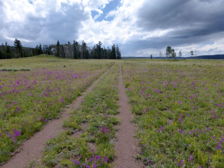
This was an interesting day. The trail in Segments 18 and 19 is mostly old ranching roads, leading through rolling fields used for grazing. There were often no trees anywhere near the trail, so there was no shade or shelter from storms. This was the first preview of the coming splendor of the San Juan wildflowers.

134I was hiking alone for the entire day, making my way across gentle but seemingly endless dirt roads through grassland. I could see San Luis Peak in the distance, which I would be passing by in a couple days. Afternoon thunderstorms rolled in over the Cochetopa Hills, and I watched intently as scattered showers formed and lightning made contact with nearby ridges. There wasn’t much I could do to protect myself from lightning other than keep moving and hope to be near a patch of trees if it got really close. Miraculously, the worst of the storms did not pass directly over me and I made it back to a forested area eventually. I crossed a small, high meadow once the sun came out. I was hiking down towards Cochetopa Creek with a ridge to my right. I had just noticed how bright it was with the sun out and it suddenly got extremely bright. Before I could even react, a crack of thunder split the air around me – lightning had struck the high point on the ridge above and behind me maybe a few hundred yards. That got my heart pounding! I was sheltered by trees so I waited a few minutes and then get on my way. I wanted to camp near Cochetopa Creek so I could have a short day the next day when I met Bill.

I found Tony, Kate, and Dan who I had been hiking with regularly for several days. We had a fire, drank some rum that Tony got in town, and I asked them to take a picture with me – since I was doing a short day the next day to meet Bill, our schedules would no longer align and I didn’t know if I would see them again. It was indeed the last night we camped together.

027

Dan, me, Tony, Kate

Day 25, 7/18. Cochetopa Creek to Eddiesville Trailhead. 6 miles, 920′ gain

11891142_10206198246009869_8583787827605613204_n

I was the last one out of camp today, but I left soon after my friends. About two miles from where we camped, the trail crosses Cochetopa Creek. There used to be a two-log bridge, but it washed out in the last year or two, so now the only way to get across is to walk. I put on my sandals/camp shoes and saw Tony, Kate and Dan on the other side drying off. They showed me the shallowest place to cross, which was still about knee-deep. I got across and put my shoes back on,. telling the three of them I hoped I would see them again. It rained for a bit while I hiked toward the Eddiesville trailhead, but had just stopped when I arrived and looked for a campsite near the road where Bill could find me. I got there at about 1pm, set up my tent, and finished reading Into Thin Air on my Kindle app. A few hours later, I saw Bill’s jeep pull up. His friend Jody had agreed to drive it back to Salida. I made room in the tent, we made dinner, and Bill was thrust into the world of through-hiking!

138

Day 26, 7/19. Eddiesville trailhead to San Luis Pass. 12 miles, 3590′ gain

11825901_10205862008442697_4353650209609237812_n

Bill’s first steps on the trail, with me assuring him that he’ll love it

Bill really got thrown into the fire on his first day. From the Eddiesville trailhead, the trail gently winds towards the saddle of 14,000ft San Luis Peak, across the Continental Divide at 12,366′, and then San Luis Pass. The day started off pretty pleasantly, with no rain but a foreboding misty fog typical of the San Juans hanging over San Luis Pass. Skirting a meadow, we saw a moose and talked with Pony, a solo through-hiker who stopped to chat and take photos of the moose.

031

We made our way up towards San Luis, with me on my seasoned trail legs and Bill on his first day, and slowly made it over the Divide. It was then that the fog dropped, causing an eerie loss of visibility and a wet heaviness to the air. Then, it started raining. Hard. As became more common in the San Juans, the trail remained above timberline for nearly 20 miles, making it impossible to get shelter from the rain. We were trying to at least get into a lower drainage area that might contain trees, but that meant having to ascend a 12,887 foot high point on Peak 13111 first. The rain persisted and I pushed on as the trail went through tight willows on either side, lashing me with their wet branches. It was nearly 6:30pm when I realized I still couldn’t even see this high point and didn’t know how long it would take to get to possible shelter.

11856415_10205862008882708_4636507079894718935_o

My last smile that day as the fog descends

I had never been so thoroughly soaked and freezing before. I went back to Bill and he asked me if I wanted to quit and go back to Creede. I really considered it, but it was out of the way and the idea of giving up after over 300 miles because of “a little rain” was unacceptable to me. We agreed to turn around, set up camp in the first available spot, and see how it was in the morning. If it rained all night and into the next day, we would call it and go to Creede. We found a wind block and mostly flat area next to some willows, and crawled into the hastily set up tent. We shivered and cooked dinner huddled inside the tent, the air frigid and damp at almost 12,400 feet. We warmed up as much as we could and hoped that our clothes would dry out in our sleeping bags. The rain and moisture in the air this day ruined my camera, so my photos after this point all came from my iPhone 5. That was a huge disappointment.

Day 27, 7/20. San Luis Pass to Spring Creek Pass. 14.3 miles, 2760′ gain

Miraculously, we awoke the next morning to a clear. blue sky with mostly dry clothes. I was filled with relief and glad that I decided to take a chance. We packed up and headed immediately up to the high saddle, with new hope.145

Our objective for the day was to get past Snow Mesa, a vast alpine plateau that is part of the geologically fascinating San Juan mountain range. This day is spent almost entirely above treeline, and the goal is to descend after Snow Mesa and get back into the forested area near Spring Creek Pass. It was only Bill’s second day, and he had an understandably slower pace than I was used to.I was worried about time, but we had no choice but to push  at least 13 miles before the afternoon storms where we could get shelter to camp in.

11253594_10205862008922709_910312027318997576_n

Snow mesa was breathtaking. After rounding the shoulder of Peak 12813, it became visible along with a a spectacular view of the Uncompahgre Mountains and Rio Grande Pyramid. We hiked atop the mesa for 3.3 miles as we watched storm clouds form in the distance. A familiar swirl of mist came down the ridge alongside the mesa, and soon the trail was enshrouded in its sinister quietness until hail started coming down. It was over fairly quickly, and we eventually got to the edge of the mesa and descended into the forest. We crossed Highway 149 and walked into the Spring Creek Pass trailhead area where we set up camp.

11230110_10205862009442722_157821824563086628_n

Day 28, 7/21. Spring Creek Pass to Segment 22 mile 8.7. 8.7 miles, 1700′ gain

After two grueling days in the alpine, it made sense for today to be a lighter day, and to camp under tree cover for the last time for the next several days and over 40 miles. The day began with a hike up Jarosa Mesa, another high alpine mesa with incredible views of the nearby Uncompahgre Mountains. Wetterhorn and Uncompahgre Peak were to the right as we hiked along the mesa. We descended through a grassy area and back into the pine forest, where we set up camp near a marshy area. 152

An iPhone quality photo of Uncompahgre Peak

There were several other hikers camped in the other campsites in the thickly wooded area to the south of the marsh. We were able to get a fire going, and were joined by our neighbor after dinner. I had been told about him from another hiker – he was from Florida and was section hiking different parts of the trail. His name was Hamid, and he was from Iran where he had lost a few family members during the war in the early 80s before escaping to the United States. He insisted on sharing food with us, and we had a great chat. He is one of my favorite people I met on the trail. He was going the opposite way as us, so we wished him a good hike before retiring to bed, knowing that we wouldn’t see him again.

Day 29, 7/22. Segment 22 mile 8.7 to Cataract Lake. 14.5 miles, 3000′ gain
156

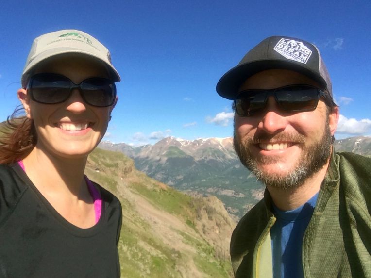
We headed out in the morning and walked through the last forest we would see for many miles. We climbed steadily up to the Continental Divide at 13,055′, getting views of Lake San Cristobal and nearby 14ers Redcloud, Sunshine, and Handies Peaks. After a few ups and downs between 12,000 and 13,000 feet, we reached the highest point on the Colorado Trail at 13,271′.

163

We descended to the trail junction at Carson Saddle, and then had another climb to a pass at 12,919. On the other side of the pass was a vast expanse of yellow wildflowers and my first time seeing the Grenadier range. The distinct silhouettes of Vestal and Arrow Peaks were  in view for a short time before we descended toward Cataract Lake.

11825208_10205862012442797_6756013275337003977_n

We set up camp near Cataract Lake, an alpine lake at about 12,400 feet. It was peaceful, and we were camped near a few other through-hikers, including Pony.We prepared for a chilly night and a tough day the next day.

Day 30, 7/23. Cataract Lake to Elk Creek drainage. 18 miles, 3800′ gain169
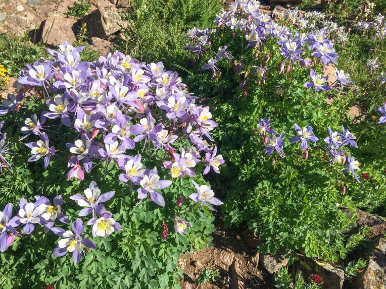
This was one of the hardest days, but also the one with the most spectacular scenery. The wildflowers were at their peak, and very abundant along the trail. We hiked out from Cataract Lake and headed up and down high valleys and admired the striking landscape of the San Juan mountains. We needed to get through Stony Pass and across another high mesa area. The goal for this day was to continue through the alpine before finally descending into the Elk Creek drainage in the Weminuche Wilderness.

172

The trail snaked through alpine meadows flush with wildflowers, surrounded by the typical rocky, jagged ridges in the San Juans. By this time, I was getting pretty confident in my ability to finish the trail, and I was getting very excited about hiking through the Weminuche. We hiked up and over the aptly named Stony Pass, and into increasingly interesting terrain.11885289_10205862013242817_835927806685622897_n
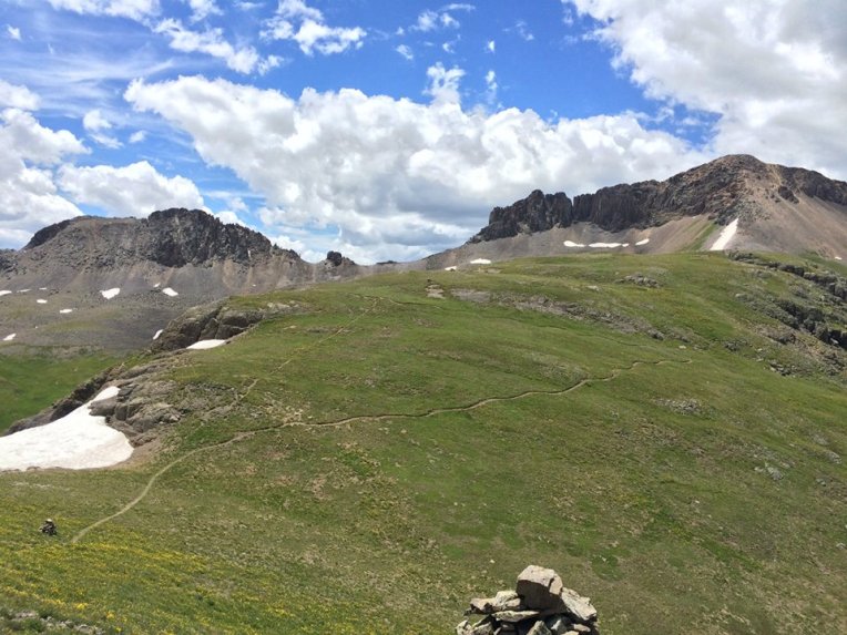
We contoured around Peak 12721 and got an even closer view of the Grenadiers. We still had almost ten miles to go before we would descend into the trees below them.

173

The trail crossed one more long, high mesa, following the Continental Divide. Finally, we split off from the shared Colorado Trail and Continental Divide Trail, and got our first glimpse of where we were headed.

181

This was the area that I had been waiting for. When I was having a tough day, I reminded myself that I was hiking towards the most awe-inspiring landscapes that Colorado has to offer. This is one of the most dramatic landscapes I have ever seen. The mesa descends sharply down a lush green hill exploding with wildflowers, taking 28 switchbacks and then following Elk Creek down into the canyon. White Dome and the eastern edge of the Grenadier range loomed above and to the left, with the abrupt edge of the mesa to the right.

11828621_10205862014842857_6363056160553780765_n

13,627-foot White Dome

178

28 switchbacks descending nearly 2,000 feet to the canyon below

We made it down the switchbacks and the canyon narrowed, with thousand foot waterfalls on the opposite wall from snow melting off Peak One and Two. Finally, we got back to timberline and I inhaled the sweet smell of the forest. We set up camp near Elk Creek under tall pines.

Day 31, 7/24. Elk Creek to Molas Pass. 11.5 miles, 2280′ gain
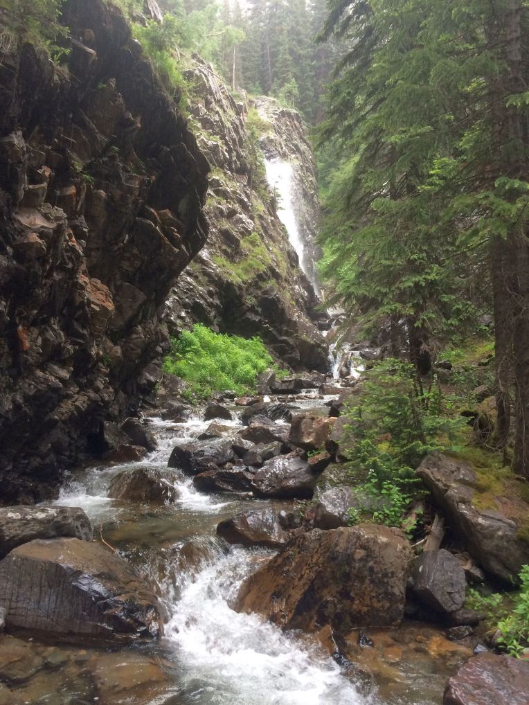
190

Our elation from the previous day was short-lived. We awoke to a gray sky and it began drizzling right as we got on the trail. I had been eagerly anticipating getting great views and pictures of the now very close Grenadier peaks. Unfortunately, we had another day with weather typical of the area – rainy, with low clouds and fog obscuring most of the views. My shoes and socks got soaked, again, and I was in a mood where I was very sick of hiking and getting rained on.

192

We continued along Elk Creek, getting a pathetic photo of Arrow and Vestal, and continued in misery. We kept descending all the way to the Animas River, where we crossed it on a bridge at around 9,000 feet. The air felt rich and warm after spending so much time in the alpine. We saw and heard the Duramgo-Silverton Narrow Gauge train several times as its tracks followed the river. We then had to climb back up 2,000 feet to Molas Pass. While on the switchbacks, we were treated to an impressive view of Mount Garfield looming above the Animas River.

199

Though it was a shorter day, we arrived at Molas Pass exhausted and set up camp near the campground. It was probably the least-secluded area in this entire leg of the trail.

Day 32, 7/25: Molas Pass to Cascade Creek. 14.8 miles, 2370′ gain

We began our day by hiking through the Little Molas Lake campground and up a short section of trail with a lot of day use. We were stopped by an older couple from Texas, who seemed flabbergasted when we answered their questions about where we were from and how long I had been on the trail. Yes, all the way from Denver. About 400 miles. A month. Yes, really. They took a photo of us and we saw them a few more times on the trail before they headed back. We had a great view of Engineer Mountain across the basin as we circled around it.

11826069_10205862016882908_1384270838709943066_n

A rib cage, with Engineer Mountain in the background

I stopped to take a break and Bill made a comment telling me basically to hurry because he “just wants to get [the hike] over with” so he could get back home to work. I was incensed. I did this hike to escape the stresses of my real life – an extra semester of college, student loan and credit card debt, a low-paying job… On the trail, I could forget about those things. Bill couldn’t wait to get back to it. I was so upset that I hiked at my normal pace, leaving him behind, angrily realizing that our connection to or reasons for being on the trail were likely very different.

Eventually we talked it out and continued the day together. We found a great campsite near Cascade Creek, where we did some laundry, had a fire, and were visited several times by two curious deer.

10999892_10205862018722954_8269487547321179681_n

Drying socks over a fire, with mixed results

Day 33, 7/26: Cascade Creek to Straight Creek. 14 miles,  2730′ gain

11231209_10205862018402946_565866268135538554_n

This was a good day. Bill had finally gotten his trail legs, and the hiking was very beautiful. We contoured around a ridge and then up to a saddle, where we were greeted with an awesome view of Lizard Head and the Wilson group.

221

The wildflowers were still incredible, and the landscape was always changing. We went up and down forested ridges and then the trail went up a long ramp and over Blackhawk Pass. We descended steeply off the pass and to the headwaters of Straight Creek just below timberline. We had a great campsite all to ourselves and some very bold squirrels.

11880368_10205862024043087_5135416483812696593_n

Day 34, 7/27: Straight Creek to Scenic Overlook. 15.7 miles, 2060′ gain

This was a day of mostly uneventful forest hiking. Much of it followed old logging and forest service roads. We hiked away from Blackhawk Pass and through flat forest, passing one solitary bump in the forest named Orphan Butte. Finally we ascended a ridge and followed a sign at a trail intersection promising a scenic overlook. We found a campsite along the way and then continued and walked out onto a precipice with nearly 360 degree views. To the north, we saw a now faraway Blackhawk Pass, and all along the horizon we saw recognizable peaks like Sneffels, Eolus, Pigeon, Turret, and others. We only had two more days of hiking ahead of us, and we shared a flask of whiskey that Bill had packed.11800278_10205749874799426_2564723390829589156_n

Day 35, 7/28: Scenic Overlook to Junction Creek. 15.4 miles, 1980′ gain

233

Despite being our second-to-last day, the trail kept providing more fantastic scenery. After leaving the campsite, we slowly ascended through forest to alpine meadows up onto Indian Trail Ridge, a series of rounded high points covered in wildflowers with great views of the Hesperus group. We traversed the ridge and then  had a steep, rocky descent toward the picturesque Taylor Lake. We went over Kennebec Pass, then descended back into the forest to find our final campsite. We followed Junction Creek down to 8,500 feet, soaked our feet, and set up the tent for the last time.

11836659_10205862025163115_4735727941128515927_n

Hiking through cornhusk lilies on the way to Kennebec Pass

11824928_10205862027203166_6023988255896086845_n

The last of many waterfalls I saw

Day 36, 7/29: Junction Creek to Colorado Trail Southern Terminus. 14.4 miles, 1370′ gain

The final day of my Colorado Trail through-hike. It didn’t seem possible, but I was going to finish the trail. We took down the tent and packed up for the last time, and started hiking toward Durango. The dramatic scenery was all behind us, and I found myself simultaneously being excited to finish, but sad to be leaving the trail. The last landmark is “Gudy’s Rest”, a bench and overlook named for Gudy Gaskill, the “Mother of the Colorado Trail” and one of its founders.11863439_10205862027683178_5324014928958159176_n
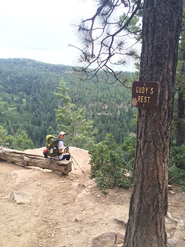
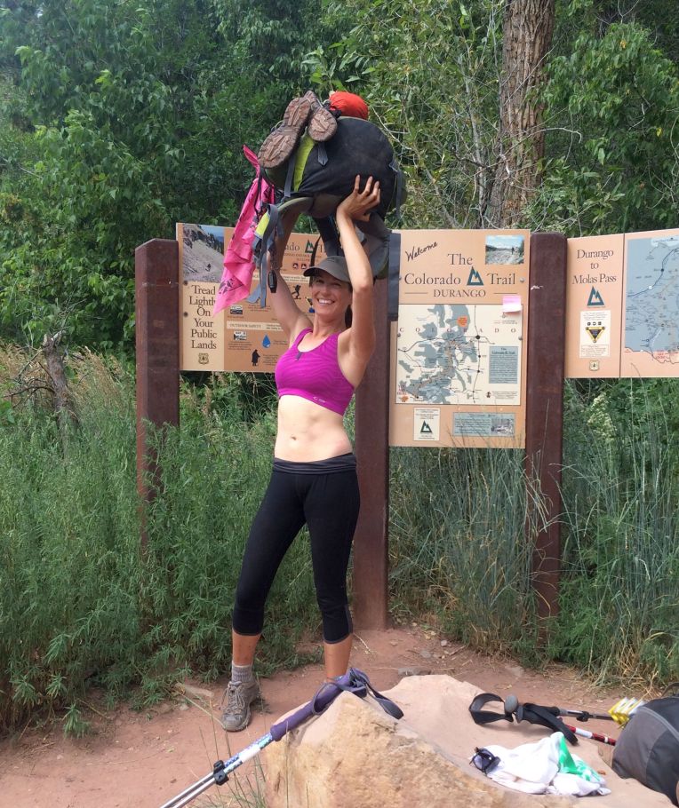
Before I knew it, we started seeing more and more people, casual hikers, on the trail. We crossed Junction Creek one last time, followed it, and then walked into the parking area at the trailhead. We were greeted by two amazing friends, Steve and Caitlin, who had driven to Durango to pick us up and hang out for a couple days. I don’t remember exactly what was going through my mind as I lifted my backpack over my head in pride, but it felt pretty great.
246

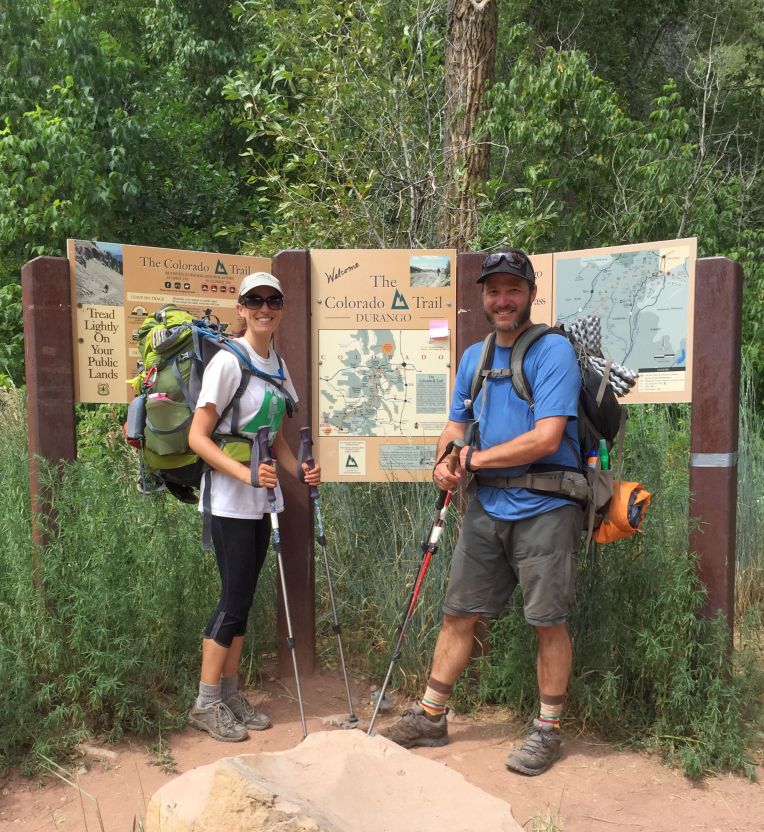
Bill and I posed for some pictures, and then got in a car and drove back to civilization.
243

***********************************************************************

The shower and meals that followed were incredible. I had lost 15 pounds and needed to buy new clothes in Durango. We enjoyed walking around in town, eating great food and having a few drinks. Bill and I got a deep tissue massage the next day, which I cannot recommend highly enough. Tony finished just behind me but had to leave for a wedding, so I didn’t get to see him in town. Dan and Kate finished the day after us, and we were able to meet up for pizza and drinks that evening.

People’s first question to me is “Why did you do it?” and I’m afraid I don’t have a great answer. Soul searching, a break from civilization and reality, and the ultimate test of my mental and physical endurance is pretty accurate. It was the hardest thing I’ve ever done, as well as the best. I would love to hike parts of it again, or if I’m being honest, the whole thing if I got the chance. But I know that I can never again have the exact same experience, which is why I am preserving it the best I can through words and images.I could not step twice onto the same trail, and eagerly await the next one.

The Colorado Trail – Part 3

The third week of my solo through-hike of the Colorado Trail

Day 15, 7/8: Mill Creek to Clear Creek. 19.5 miles, 2000′ gain

112

“Today started out miserable but ended up being great! I woke up and it was raining. Miserable, shitty, wet, no sun for the fourth day in a row. I got ready in the rain, packed up my saturated tent, cried, and got on the trail. I found LTE service shortly after and talked to Bill and checked Facebook and found a lot of encouraging things from friends, which lifted my spirits. I continued and once I got near Twin Lakes, it stopped raining and the sun actually came out. Lots of easy hiking put me well past my original planned campsite, so I ended up doing about 19.5 miles to CR390 and found Tony with five other young through-hikers and we had a great evening talking and having a fire. I met another girl solo hiker for the first time, Kate, who is also 26 and from Denver. Hopefully I will always have someone to hike and camp with now! Looking forward to more!”

114

 Descending the switchbacks to County Road 390 (to Missouri Gulch area), I was treated to a rare sight – the hillside was covered in blooming cacti!


Day 16, 7/9: Clear Creek to Three Elk Creek. 15 miles, 4380′ gain

020

“A totally brutal day, yet not too bad. 15.3 miles and 4,380 feet of gain hurt but I did it! Pretty views of Harvard and the Arkansas River valley. Passed the 200 mile mark, which felt good. Pushing hard today and tomorrow to arrive in Salida on Sunday afternoon, a day ahead of schedule.”


Days 17-20, 7/10-13. Three Elk Creek to Segment 15. 51.5 miles, 9,280′ gain

021.JPG022

Mt. Yale (top) and Mt. Princeton (above)

“Past three days – 7/10 was difficult, a steep climb to the summit ridge of Yale, about 12,000 feet. Did not get as many miles as I wanted that day. 7/11 I did 20.5 miles to get close to Salida, which was punishing. Yesterday made it all worth it, though.

11701121_10205649328165823_6792580201685453270_n

About to eat non-dehydrated food. I couldn’t contain my excitement!

I did 8.3 miles and met Bill at the Angel of Shavano trail head. He got us a nice hotel room and I took a shower. I look pretty different, very skinny. I did some laundry and we got dinner at Boathouse Cantina, which was amazing! Fish tacos (yes, occasionally I will eat fish) and the best green chile I’ve ever had. Had a drink at Deerhammer and witnessed a gorgeous sunset, then back to the room. Being in a bed for the first time in almost three weeks felt incredible. Surprisingly I didn’t sleep too well, but having Bill with me all night felt great. We went out for breakfast in the morning, and I was pleasantly surprised to get a gluten free pancake!

126

Sunset over Buena Vista

I got back on the trail with the promise of seeing Bill on Saturday to join me. I can’t wait! The rest of my hike today was ok. I got caught in some rain and crossed Highway 50 and caught up with another trail friend, Reed. We were walking up the road in the rain when it started pouring. A nice older couple with a dog in an old Subaru Outback pulled up next to us and offered to drive us about two miles up the dirt road to the next trailhead and we accepted. They said it would be a very unpleasant walk. No regrets. They were really nice. I hiked several miles in, with hail and pouring rain, and set up camp pretty early. Hope to get a nice day tomorrow.”

Days 21-22, 7/14-15. Monarch Crest to Baldy Lake. 33.6 miles, 5520′ gain

130

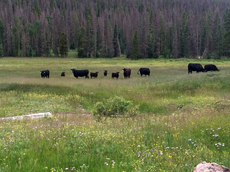
Lots of cows in these segments

“Nothing remarkable about yesterday or today. It was necessary to camp at about 11,200 both last night and tonight, and it is very cold and windy. I didn’t sleep well last night thanks to the tent thrashing in the wind, looks like it’ll be the same tonight. I do not enjoy doing more than 15 miles in a day.”

Day 23, 7/16. Baldy Lake to Pine Creek. 15.2 miles, 2250′ gain

131

Seriously, so many cows

This day was too miserable for me to write a coherent journal entry. I will paraphrase: my back hurt, the forest was ugly and repetitive, there were too many ups and downs to count, it would start and stop raining as soon as I had removed or replaced my rain cover, a fly flew INSIDE my ear, I slipped and fell on a steep downhill, and when I got in my tent to go to bed, I realized that about 16oz. of my water had leaked inside my tent. Bad times.

Unfortunately, this was my last journal entry. I will attempt to relive and describe the rest of my trip from memory, but again, I am extremely disappointed that I didn’t keep writing about my daily experiences.

The Colorado Trail – Part 2

Continuing my unabridged trail journal entries for the solo portion of my through hike

Day 8, 7/1: Segment 6 mile 19 to Horseshoe Gulch. ~9 miles, 1500′ gain

080

“Today I took a much-needed shorter day, only a little over 9 miles. My feet are definitely feeling the stress, and I took it nice and slow since I wasn’t in a hurry to get anywhere. Tomorrow my mom is meeting me in Breckenridge for resupply, laundry, shower, etc. I’m hoping to get some lunch out of it, too. I’ll do four miles, get into town around 11, then hopefully back on the trail at 3 or 4 to do about five more miles. I’m excited to start Segment 7, especially nice and clean with fresh clothes.”

Day 9, 7/2: Horseshoe Gulch to Miners Creek. 9 miles, 1850′ gain

082

“Today was a great day! I had a nice, leisurely hike down four miles into Breck. Weather was great and I arrived at the Gold Hill trail head early. Mom came a few minutes after 11 and took me to the rec center for a shower. It felt incredible to scrub away everything from the last 8 days, wash my hair, and put on a fresh, comfortable outfit. I dried my hair and weighed myself – I’ve lost five pounds. Not great, but I’ll try to eat more – which will be easy considering the huge amount of food I got today. After my shower I went to the laundromat and Mom produced a lunch she had made of potato salad and peach tapioca with iced tea. It tasted great! After the clothes were done, I changed into a clean hiking outfit and picked up a few things at City Market and then returned to the trail. Mom walked for a bit with me, and just as she was about to turn around I got a text from Tony – he was just getting on the trail, too. My mom said hi to him on her way down, haha. The 4.8 mile hike up from Miners Creek trail was pretty difficult. My backpack is filled to capacity and I’m guessing it weighs about 50 pounds now. It definitely hurts. But I feel refreshed. Had a good dinner and nice evening in camp with a fire – it’s good to be back with my trail friend. Tough day ahead tomorrow with a climb over the Tenmile range, but it should be beautiful.”

084

The information sign at the Gold Hill trailhead had a lovely reminder of why I was there


Day 10, 7/3: Miners Creek to Segment 8 mile 5. 13.2 miles, 2950′ gain

087

“Today certainly was tough, but wow! A steady climb out of camp led to the first serious snow I’ve encountered, which was mostly manageable. In three miles I topped out on the Tenmile, and what a sight. I could see the southern Tenmile peaks, Grays and Torreys, Georgia Pass, and the northern Sawatch. A few minutes after we sat down for a snack at 12,400′ we were approached by a curious mountain goat! A long, steep descent followed, and we headed towards Copper Mountain. Right after crossing Highway 91, a group of three people in a truck offered us root beer floats, cookies, bananas, and camp chairs. Despite not being able to enjoy any of the treats, I was very appreciative of this “trail magic” and I hope it’s not the last I see of it. Several miles through Copper’s ski slopes and dense forests was interesting, and we ended up camped in a nice valley between two streams. Tomorrow offers another climb above 12k’ but with fewer miles. Excited for more!”

086

089

Day 11, 7/4: Segment 8 mile 5 to Segment 8 mile 20. 15 miles, 2500′ gain

094

“Today was pretty brutal. Neither Tony nor I felt like getting up early, so we got a bit of a late start. The hike up to treeline wasn’t that bad, but we stayed at or above it, mostly above 12k, for over four miles. AMS and the effects of a heavy pack and not enough calories took their toll on me. We wanted to camp near mile 16, but all the spots were taken, so we ended up doing 4 extra miles. I cried and for the first time thought about quitting, but I got over it. Tomorrow should be shorter, prettier, easier, and more fun.”

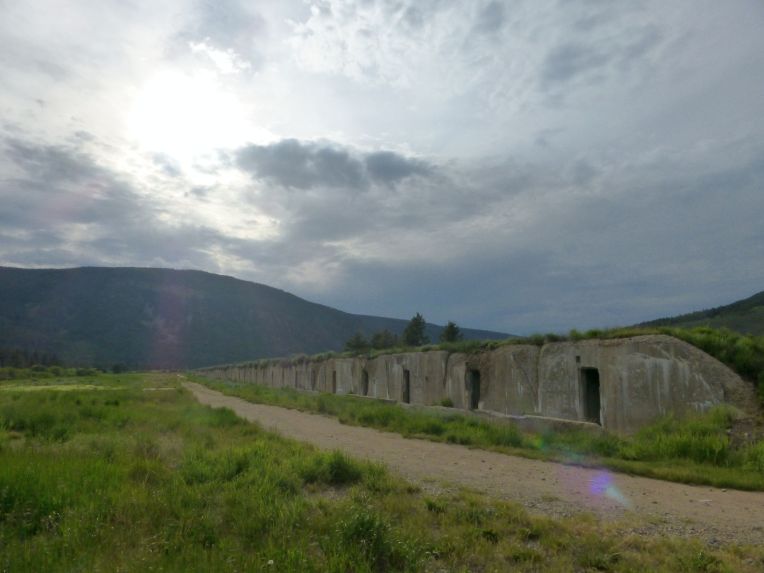
Apparently I didn’t consider the old bunkers at Camp Hale worth mentioning, but they were pretty cool.

015

Day 12, 7/5: Segment 8 mile 20 to Wurts Ditch. ~9 miles, 1400′ gain

016

More ruins from Camp Hale, near Tennessee Pass

“Today started out pretty well, we slept in and got a late start on our short day. Around 12:30 it started raining and didn’t stop for hours, which definitely brought down my spirits. Fortunately the trail was gentle, well-built, and mostly through forest. It finally cleared up around 3:30, and shortly after that we found a great campsite and set up camp. Then it rained again for maybe an hour. It stopped again, and we started making dinner. I had just started up the Jetboil when I saw someone walking towards me. It was Bill! He saw my location on my SPOT receiver and drove right near where we were camped! He couldn’t have come at a better time, as I had been running low on food and not in the best spirits. It was so good to see him! He, Tony and I hung out for a few hours and had a beer, then he left as the sun set. Now it will only be a week before I see him again! He makes me so happy I can hardly believe it. It was the best surprise at the best time! Whatever tomorrow brings, I will be fresh and full of love after this evening 🙂 ”

097

Someone built this lovely swing along the trail, just after Tennessee Pass.


Day 13, 7/6: Wurts Ditch to Mt. Massive Wilderness. ~15 miles, 3100′ gain

099

“A pretty miserable day, after all. It rained for much of the night and then the sun didn’t come out in the morning, so the tent and rain fly were all wet. It rained pretty steadily all day, so my feet were wet and I was not in the best of moods. Tony left well before I did, s I hiked alone all day – rain and a brutal 1000 foot climb from mile 11 to 13 really sucked. Got some good views of Mount Massive, though. 15.7 miles and 3,100 feet of gain is a pretty big day for me, still. Tony seems to be getting stronger, and I think I am still losing weight and my backpack is too heavy. He is going to Twin Lakes tomorrow evening, so there’s a chance I won’t run into him again. I hope I do, it has been great having a trail friend. Hope tomorrow is easier and better weather!”

018


Day 14, 7/7: Mt. Massive wilderness to Mill Creek. ~12 miles, 1600′ gain

105

“Day 3 of monsoon rain. It really fucking sucks. Rain all day, everything wet, creek crossings, ridiculous. I really miss seeing the sun. Tony left early this morning while I refused to get out of bed because it kept drizzling. I eventually hit the trail around 11, promising myself a short day. The hiking was pretty good, but the weather is just awful. I found an acceptable campsite and mercifully the rain stopped long enough to get my tent set up and make dinner, but before I could even eat it started again. It is now 6:30 and I am stuck in the tent while it’s pouring outside. A break from this, even just one day, would be really fucking nice. Too many days like this will make me quit.”

Not a great way to end Part 2, but wait – there’s more!