
Date: 7/11/2018
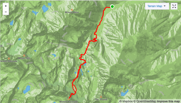
Mileage: 16.1
Elevation Gain: 7,400
Strava Track:
After getting our asses kicked on Split Mountain, we discovered that the fire we had observed over the last two days had closed access to not only the Whitney Portal area, but also Shepherd Pass, the location of our next objective. We went into Bishop and looked at my woefully inadequate guidebook to see if there was a different peak we could work in instead. We settled on Middle Palisade, which can be accessed from the east via the Glacier Lodge/South Fork of Big Pine Creek trail.
 Middle Pal and Norman Clyde from the trail
We got on the trail just before 7 and were immediately impressed with the well maintained, well marked trail. We were making excellent time compared to our previous approach! This enthusiasm was short-lived. Less than 2 miles in, we reached a creek crossing. There was no bridge, no log, and no place to cross that was shallower than hip deep, rushing water. All three of us being of short stature quickly decided that wading across would not be safe. We went up and down the side of the creek and bashed through thick willows looking for any rocks, logs, or shallow areas while being eaten alive by mosquitoes. Finally we went 100 yards or so to the right of the trail and found a series of shallower areas with branches that allowed for an adventurous and foot soaking crossing. We rejoined the trail and continued on our way.
Switchbacks lead up and over a headwall and pass, then the trail descends into an area best described as ‘mosquito apocalypse’. This is a lush area near the junction of the Brainerd Lake trail and the trail to Willow Lake, which was allegedly even worse for mosquitoes. We tried to hurry through the area while also being confused about our mileage. We were using an AllTrails track that said the hike to Brainerd Lake is 7.4 miles round trip, so when we had hiked over 3.7 miles we knew that wasn’t the case. Do NOT trust California route descriptions!
We arrived at the lake at about 10. The lake is 5 miles from the trailhead. It is also just as much of a mosquito apocalypse as the lower section. Not knowing any better, we set up our tents in a not so great site and retreated a while for a rest and break from being devoured. It looked like it was going to storm again, but instead it just got very hot. We stupidly decided to make another afternoon summit bid. It was about 1pm and we decided we’d rather have to only hike out in the morning, so we headed for Middle Pal.
 Gorgeous blue water in Finger Lake
There is a cairned trail at the NW end of the lake that takes you up to Finger Lake, which is gorgeous and has many far better campsites. It also seemed less buggy. So I would definitely recommend taking the extra few minutes to get above Brainerd. The trail will take you to the end of the lake on the left side; cross to the right over some boulders at the lake’s outflow to begin ascending towards the glacier. Follow cairns as you continue south over a higher, rocky area. Aim for the cleft between the Palisade and Middle Palisade glaciers. You will now see the east face of Middle Pal.
 Near the entrance to the gully
Supposedly there is an entrance to the class 3 east face here, but we had a photo that was taken from Thunderbolt Peak and not the top of the Middle Palisade glacier, making it difficult to discern rock features relative to snow level, etc. We saw a line up a gully of red and white crumbly rock, which then led up to the left to more solid rock and a good ledge system. The climb up the face/gully is long but not bad and not super exposed. In retrospect, I’m not 100% sure it wasn’t the east face. Either way, we continued up a pretty obvious route and topped out just below the summit block. We went around the left side and scrambled up large blocks to the summit.

The Palisades are truly breathtaking. I had seen them from a distance from the JMT and from the approach, but their small, dramatic summits are best appreciated from up close. We spent a few minutes enjoying the views and then headed down. The descent down the face wasn’t as bad as expected, and once back on the glacier we made quick work of the sun cupped snow. We found the cairned route through the boulders, past Finger Lake, and back towards camp as darkness fell. We fell asleep quickly.
The hike out was uneventful although the mosquitos seemed much worse than the day before. Knowing the way across the creek, we got through much more quickly. We enjoyed the easy hiking on good trail and were back to the car in no time. We drove back into the valley, went for a soak in the hot springs, and then headed up to Horseshoe Meadows to get some rest for the next day’s objective, Mount Langley.
Relive 3D Topo/GPS

Hello! I recently found your photo of Middle Palisade and was wondering if I could use it in a research poster and presentation.
We are hoping to request permission to use the following image: https://neverthesametrailtwice.files.wordpress.com/2018/10/img_9357.jpg?w=2184&h=800&crop=1
Thank you!
LikeLike
Yes you can, thanks for asking!
LikeLike
Thank you!
LikeLike